Synopsis:
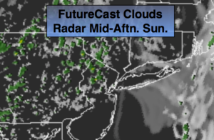
Easter Sunday will feature a mix of clouds and sun. A spot shower can’t be ruled out as an upper level low moves over the area. A decent day looks to be on the way, despite a few drops!
On Monday, the upper low looks to stall for a time. Some of the models redevelop a low just off the coast. If this pans out Monday will feature a mix of clouds and sun with scattered showers in the afternoon. The best chance will be over Eastern sections.
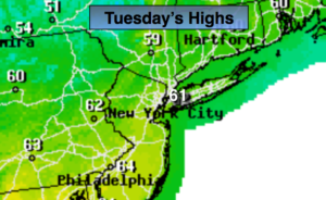
Tuesday will be partly sunny and much warmer.
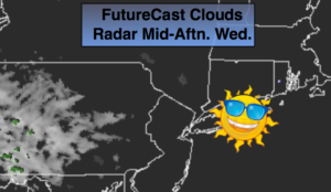
The midweek period will feature tranquil conditions as high pressure dominates.
Keep it here for a no nonsense, no hype forecast.
Stay tuned.
Easter:
Clouds and sun. Spotty showers. Most of the time will be dry. Highs in the mid 60s. Southeast winds at 5-10mph.
Tonight:
Partly cloudy. Lows in the lower to mid 50s in the City, the upper 40s inland. Southeast to Northeast wind at less than 5mph.
Monday:
Sun to clouds with afternoon showers possible, especially likely over Eastern sections. Highs near 70º.
Tuesday:
Partly sunny. Warm. Highs in the mid to upper 70s.
Wednesday:
Partly sunny. Highs around 70º.
Thursday:
Partly sunny. Highs in the mid to upper 60s.