Synopsis:
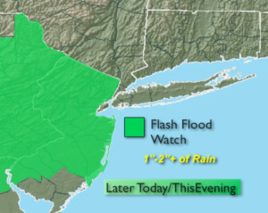
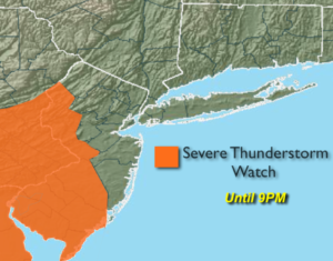
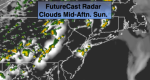
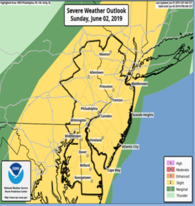
A Severe Thunderstorm Watch is in effect for all of NJ until 10PM. Severe thunderstorms contain either of the following criteria: winds in excess of 58mph and or one inch hail. The storms will be scattered and not all areas will get in on the action.
After the storms wind down later this evening it will become partly cloudy and much cooler as the cool front works through.
Monday and Tuesday will be bright and cool for the beginning of June as a cool pool of air works in from Canada.
A Southwest flow will develop on Wednesday and Thursday as high pressure settles over the Southeast. This will result in readings once again at or above 80º. A spot shower can’t be ruled out.
Keep it here for a no nonsense, no hype forecast.
Tonight:
Scattered showers and storms this evening otherwise partly cloudy, much cooler and less humid. Lows in the upper 50s in the City, the upper 40 inland. Wind becoming Northwest at 8-12mph.
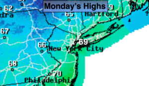
Monday:
Partly sunny, cooler and breezy. Highs in the upper 60s. Northwest wind at 10-20mph.
Tuesday:
Mostly sunny. Highs in the lower 70s.
Wednesday:
Partly sunny. Warmer. Stray late day shower. Highs around 80º.
Thursday:
Partly sunny. Warm. Stray late day shower. Highs in the lower 80s.
Friday:
Partly sunny. Highs in the mid to upper 70s.
 s
s Today: