Synopsis:
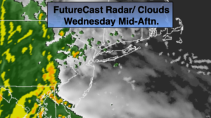
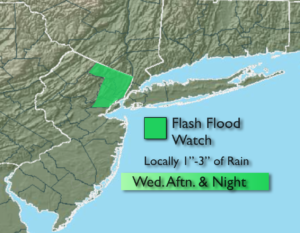
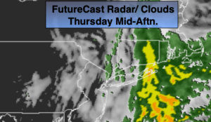
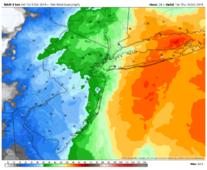
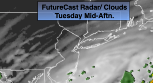
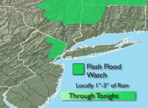
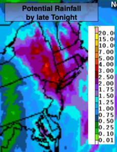
A storm will deepen rapidly over our area tonight. Whether the storm’s track is just inland, hugs the coast or is just offshore heavy rain is likely into early tonight. One to three inches of rain is possible by late tonight (2nd map above) and a Flash Flood Watch is up for Northeastern NJ and up the Hudson Valley. Local street and highway flooding is likely. Winds may be gusty along the coast and over Central and Eastern Long Island. Some gusts may reach 40-50mph during the evening. The rain will taper off from Southwest to Northeast tonight. Winds will become strong out of the West soon after the storm moves North of the region. A Wind Advisory is up for the entire tri-state for gusts at or above 45mph.
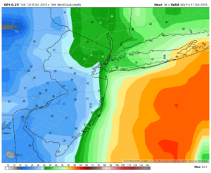
As the storm moves into Eastern New England on Thursday we’ll dry out, but a spot shower can’t be ruled out. Winds will be gusty out of the West and Northwest. Highs may remain in the 50s with winds gusting to 45mph.
Friday will be chilly with a cool pool of air over the Northeast in the wake of the departing low. Winds will abate some.
A nice weekend is on the way! Both days will feature plenty of sun and seasonal readings.
Stay Tuned.
Keep it here for a no nonsense, no hype forecast.
Tonight:
A period of heavy rain. Rain tapers off later this evening South and West and after midnight to the North and East of the City. Lows in the 40s to lower 50s. Winds becoming West at 15-30mph with gusts to 45mph.
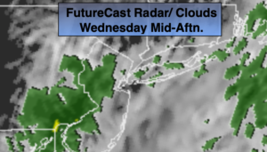
Thursday:
More clouds than sun, windy and cooler. Spotty showers can’t be ruled out. Highs in the upper 50s. West winds at 15-30mph with gusts to 45mph.
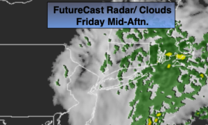
Friday:
Sun and clouds. Windy and chilly. Highs in the upper 50s.
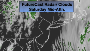
Saturday:
Sunny and seasonal Highs in the mid 60s.
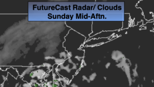
Sunday:
Sun to late day clouds. Highs in the mid to upper 60s.
Monday:
Clouds, some sun. A few showers are possible. Highs in the mid to upper 60s.