Synopsis:
Two systems will influence our weather through Friday. A low in the Western Atlantic and high pressure over Southeastern Canada. Confidence in the forecast has now increased as time closes in on the event.
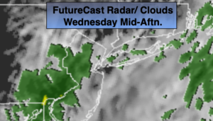
On and off rain will be with us for today as the Atlantic storm throws moisture well ahead of it. It’ll be breezy.
It looks like enough dry area will work in from the North from the Canadian high to keep much of the day dry on Thursday, especially from the NYC vicinity and to the West. Eastern sections may stay in the rain shield the majority of the day.
The models now take the storm between 100 to 200 miles Southeast of Montauk Point Late Thursday. This will be it’s closest proximity to our area. There will be a strong pressure gradient between the high and the low. This will result in windy conditions both Thursday and Friday. The heaviest rain and highest winds look to be over Eastern Long Island and Eastern Connecticut. Gusts around 50mph are possible. Winds will gust between 30-45mph over the rest of the tri-state coastal area. The heaviest rain will also be over Eastern sections with 1″-3″ of rain possible. Lighter amounts will fall in the City and to the West.
Coastal flooding is a concern Thursday and Friday. Those areas that are most vulnerable to tidal flooding should be on alert.
The storm will slowly drift to the South and then out to sea later Friday. Any rain Friday morning will taper off.
The weekend looks decent with a mix of sun and clouds and near seasonal readings, which is in the mid 60s.
Stay Tuned.
Keep it here for a no nonsense, no hype forecast.
Today:
Cloudy with on and off rain. Much cooler and breezy. Highs in the upper 50s. Northeast winds at 15-25mph.
Tonight:
Mostly cloudy, a few spotty showers are possible. Breezy. Lows in the 40s throughout. North winds at 15-25mph with higher gusts at the coast.
Thursday:
Mostly cloudy. Rain should be confined to Eastern areas. Windy. Highs in the upper 50s.
Friday:
Rain. Tapering off from West to East. Windy. Highs in the lower 60s.
Saturday:
Morning clouds giving way to afternoon sun. Highs in the mid to upper 60s.
Sunday:
Partly sunny. Highs in the upper 60s.