Synopsis:
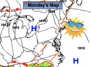
What a string of days we’ve had. Strong high pressure has influenced our weather for days and was responsible for our fabulous weather. Today will be the last day of the top ten days with plenty of sunshine and seasonal temperatures.
High pressure will move off the coast today and tonight. The wind will turn to the South and moisture will ride up and around the offshore high pressure. A weakening surface and upper level low that has been over the Southeast will also drift slowly North over the next couple of days. The result will be more clouds and higher humidity and temperatures through Father’s Day weekend. Each afternoon will feature the chance of scattered showers Friday through Sunday. It will not be a washout and there will be dry times. I am not canceling my outdoor plans this weekend!
Stay Tuned.
Keep it here for a no nonsense, no hype forecast.
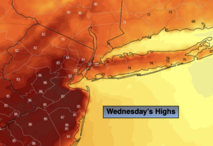
Today:
Mostly sunny. Highs in the upper 70s. Northeast to Southeast winds at 5-10mph.
Tonight:
Becoming mostly cloudy. Spotty drizzle possible with areas of fog. Lows in the mid 60s in the City, the 50s inland. Southeast to East winds less than 5mph.
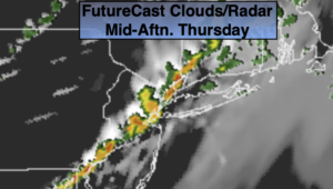
Thursday:
Morning clouds and fog. Becoming Partly sunny. Highs in the upper 70s.
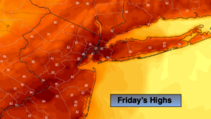
Friday:
Sun and clouds, warmer and more humid. Scattered PM showers. Highs in the lower 80s.
Saturday:
Sun and clouds. Warm and humid. Scattered PM Showers. Highs in the mid 80s.
Father’s Day:
Sun and clouds. Warm and humid. Scattered PM Showers. Highs in the mid 80s.