
Synopsis:
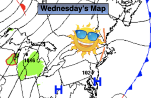
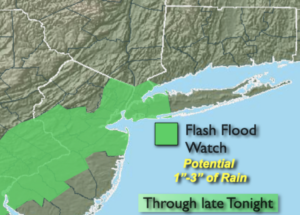
A round of scattered showers and storms are likely into tonight as an area of low pressure develops along a stalled cool front just to our West. Some of the storms maybe strong to severe this evening South of the City. A Flash Flood Watch is in effect through late tonight for the I-95 corridor from the NYC vicinity to the Philly area (map above). Areas of torrential rain is likely. Remember, never drive through a flooded roadway. TURN AROUND, DON’T DROWN. .
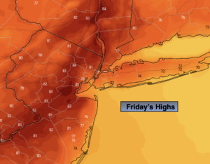
Friday will be refreshing. Temperatures will finally be several degrees below the average high of 84º. Mostly cloudy skies are expected and a spotty shower can’t be ruled out.
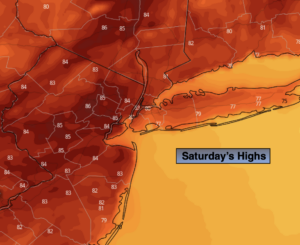
The 4th of July holiday weekend will be a 50/50 split. Saturday will feature an upper level low and surface low pressure moving through. This will keep the clouds the dominate feature in the sky. On and off showers are expected. Even a period of rain is possible in spots. This low has unseasonably cool air associated with it. Temperatures most likely will not get out of the 60s for highs! Not looking like a beach day nor feeling like Summer.
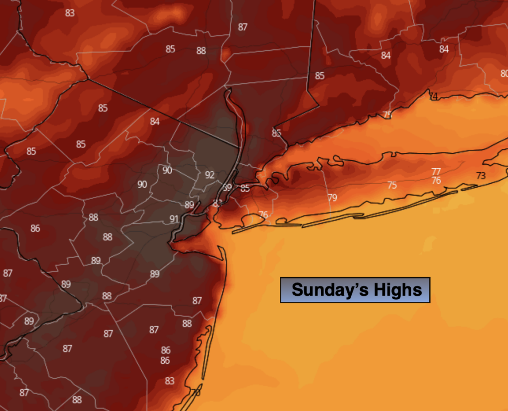
Sunday, July 4th will be the better half of the weekend. More sunshine and milder readings are anticipated.
Typical July conditions will return for the beginning of next week as high pressure builds over the Southeastern portion of the nation. The result will be increasing heat and humidity under mostly sunny skies.
Stay tuned.
Keep it here for a no nonsense, no hype forecast.
Tonight:
Scattered showers and storms. Areas of torrential rain. Much cooler than recent nights. Lows in the 60s throughout. Northeast winds at 5mph.
Friday:
Mostly cloudy. A spot shower is possible. Highs in the mid to upper 70s.
Saturday:
Mostly cloudy with scattered showers. Unseasonably cool. Highs in the upper 60s.
4th of July:
Mostly sunny. Highs in the upper 70s.
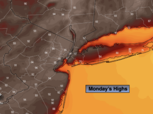
Monday:
Mostly sunny, warm and humid. Highs in the mid 80s.
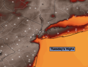
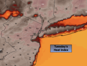
Tuesday:
Hazy, hot and humid. Highs in the lower 90s.