Synopsis:
High pressure to our West and upper level low pressure over New England will result in a cool flow through the beginning of the week.
It will be a changeable sky today. The upper low with disturbances rotating around it will cause isolated showers, most likely in the afternoon, most of the day will be dry. A mix of sun and clouds is expected and the wind will be busy adding a chill. Highs will be a few degrees below the average of 64º.
Tonight will be the coldest night of the season with readings inland getting down into the 30s inland.
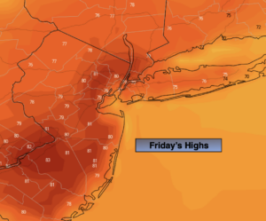
Temperatures will moderate mid to late week as milder air works around the large area of high pressure to our South. The sun will dominate. Readings by midweek will be almost ten degrees above average.
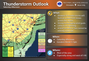
By Friday, a cool front will work through the region uneventful as its precipitation starved.
Keep it here for a no hype-no nonsense forecast.
Stay tuned.
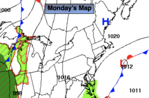
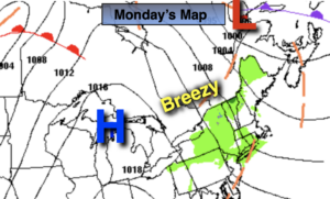
Monday:
Partly sunny, cool and breezy. An isolated afternoon shower. Highs around 60º. Northwest winds at 15-25mph with gusts over 30mph.
Tonight:
Clear and chilly. Lows in the upper 40s in the City, the 30s inland. West to Northwest winds at 8-12mph.
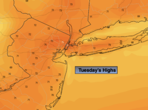
Tuesday:
Mostly sunny. Highs in the mid 60s.
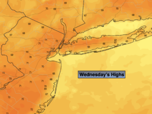
Wednesday:
Mostly sunny. Highs around 70º.
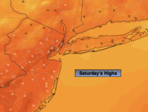
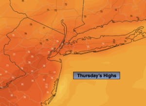
Thursday:
Mostly sunny. Warm. Highs in the lower to mid 70s.
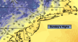
Friday:
Partly sunny. Cooler. Highs in the mid to upper 60s.