Relief Has Arrived. Seasonable Monday…


Synopsis:

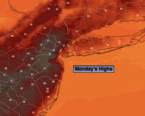
The hot spell is over. Relief has arrived behind a cool front. Readings will be near the average high of 73º under mainly sunny skies.

Tuesday and Wednesday will be comfortable with a refreshing air mass over the region as high pressure moves overhead. More clouds than sun is expected.

Thursday will be dominated by clouds as moisture builds from the South. Showers are possible but it shouldn’t be a washout.

A cool front will approach Friday with a better chance of showers.

Stay tuned.

Keep it here for a no hype, no nonsense forecast.

Monday:

Mostly sunny. Much more comfortable.  Highs in the mid 70s. North winds at 8-12mph.

Tonight:

Mostly cloudy. Lows in the upper 50s in urban areas, the lower 50s inland. Northeast winds at 5mph.

Tuesday:

Clouds and sun. Cooler. Highs around 70º.

Wednesday:

Clouds and sun. Highs in the upper 60s.

Thursday:

Mostly cloudy with scattered showers possible. Highs in the lows 70s.

Friday:

Mostly cloudy with shower likely. Highs in the mid 70s.

Catch me on the Fox Business Network from 6am-9am this weekend and on the Fox Weather Stream until Noon. Find us on Tubi, Roku TV and YouTube TV and as always the Fox Weather App. It’s Free!
Evening Spotty Storms. Relief Arrives Monday…


Synopsis:

A cool front will move toward and through the region tonight. Scattered showers and isolated thunderstorms are possible this evening. It’ll turn cooler and much less humid late tonight.

Relief will arrive Monday behind the front under a mix of sun and clouds. Readings will be near the average high of 73º.

Tuesday and Wednesday will be comfortable with a refreshing air mass over the region as high pressure moves overhead. A mix of clouds and sun is expected.

Thursday will be dominated by clouds as moisture builds from the South. Showers are possible but it shouldn’t be a washout.

A cool front will approach Friday with a better chance of showers.

Stay tuned.

Keep it here for a no hype, no nonsense forecast.

Tonight:

Scattered showers and storms early, otherwise clearing skies. Much cooler and less humid by morning. Lows in the lower 60s in urban areas, the 50s inland. Northwest winds at 8-12mph.

Monday:

Mostly sunny. Much more comfortable.  Highs in the mid 70s. North winds at 8-12mph.

Tuesday:

Clouds and sun. Cooler. Highs around 70º.

Wednesday:

Clouds and sun. Highs in the upper 60s.

Thursday:

Mostly cloudy with scattered showers possible. Highs in the lows 70s.

Friday:

Mostly cloudy with shower likely. Highs in the mid 70s.

Catch me on the Fox Business Network from 6am-9am this weekend and on the Fox Weather Stream until Noon. Find us on Tubi, Roku TV and YouTube TV and as always the Fox Weather App. It’s Free!
Sultry Sunday. Evening Spot Storm…


Synopsis:

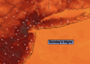
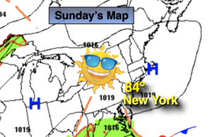
The season’s first hot spell will continue today as the Bermuda high continues to influence our weather. Highs once again will hover around 90º. It will be cooler at the coast.  A cool front will move toward and through the region Sunday evening and night. Scattered showers and isolated thunderstorms are possible toward evening.

Relief will arrive Monday behind the front under a mix of sun and clouds. Readings will be near the average high of 73º.

Tuesday and Wednesday will be comfortable with a refreshing air mass over the region as high pressure moves overhead. A mix of clouds and sun is expected.

Thursday will be dominated by clouds as moisture builds from the South. Showers are possible but it shouldn’t be a washout.

Stay tuned.

Keep it here for a no hype, no nonsense forecast.

Sunday:

Hazy, hot and humid. Scattered thunderstorms will develop toward evening. Highs in the upper 80s to lower 90s. Cooler at the coast. South to Southwest winds at 8-15mph.

Tonight:

Scattered showers and storms early, otherwise clearing skies. Much cooler and less humid by morning. Lows in the lower 60s in urban areas, the 50s inland. Northwest winds at 8-12mph.

Monday:

Mostly sunny. Much more comfortable.  Highs in the mid 70s.

Tuesday:

Clouds and sun. Cooler. Highs around 70º.

Wednesday:

Clouds and sun. Highs in the upper 60s.

Thursday:

Mostly cloudy with scattered showers possible. Highs in the lows 70s.

Catch me on the Fox Business Network from 6am-9am this weekend and on the Fox Weather Stream until Noon. Find us on Tubi, Roku TV and YouTube TV and as always the Fox Weather App. It’s Free!
Sizzlin’ Saturday…Hazy, Hot & Humid…


Synopsis:

A deep Southerly flow will develop around a Bermuda high today. This will result in readings skyrocketing to Summer-like readings. Any morning fog or clouds will give way to sunny skies. Many areas just away from the coast will crack 90º. A Heat Advisory is in effect for most of the area. The combination of the temperature and humidity will make it feel between 95º-100º. This is our first bout with hot weather. Please take it slow, listen to your body if you feel tired or cramp up. Drink plenty of fluids.

This pattern will continue for Sunday. Hazy, hot and humid conditions are expected.

A cool front will move through the region Sunday night with scattered showers and maybe a rumble of thunder. Relief will arrive Monday behind the front under a mix of sun and clouds. Readings will be just above the average high of 73º.

Tuesday and Wednesday will be comfortable with a refreshing air mass over the region as high pressure moves overhead. A mix of clouds and sun is expected.

Stay tuned.

Keep it here for a no hype, no nonsense forecast.

Saturday:

Areas of morning fog and clouds, otherwise becoming mostly sunny, hot and humid. Highs in the upper 80s to lower to mid 90s, cooler at the coast. Heat Index: 95º-100º. South to Southwest winds at 5-10mph.

Tonight:

Hazy, warm and muggy. Lows in the lower 70s in urban areas, the 60s inland. Light Southwest winds.

Sunday:

Hazy, hot and humid.  Highs in the upper 80s to lower 90s. Cooler at the coast.

Monday:

Mostly sunny. Much more comfortable.  Highs in the mid to upper 70s.

Tuesday:

Clouds and sun. Cooler. Highs in the lower 70s.

Wednesday:

Clouds and sun. Highs around 70º.

Catch me on the Fox Business Network from 6am-9am this weekend and on the Fox Weather Stream until Noon. Find us on Tubi, Roku TV and YouTube TV and as always the Fox Weather App. It’s Free!
Clouds Dominate. Sct’d Evening Storms…


Synopsis:

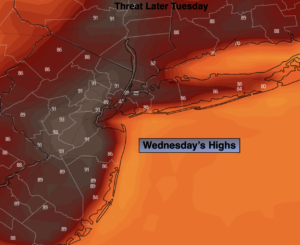
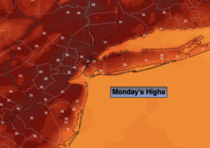
A warm front will move toward the region today. The front should make it to just South of the City by days end. This will result in clouds dominating the day with a Southeast flow off the cooler Atlantic. Readings will approach seasonable levels in the NYC vicinity (low 70s), with warmer temperatures likely over Southern and Western regions (map above). Highs here will reach several degrees above average as the wind turns off the land. Toward evening the potential is there for scattered thunderstorms along that warm front. Some of the storms could be quite strong. Skies will clear after midnight and it’ll be mid.

By Saturday, a deep Southerly flow will develop around a Bermuda high. Readings will skyrocket to Summer-like readings under plenty of sunshine. Many areas just away from the coast will crack 90º.This pattern will continue for Sunday. Sunday may very well be the hotter of the two days for the City.

A cool front will move through the region Sunday night with scattered showers and maybe a rumble of thunder. Relief will arrive Monday behind the front under a mix of sun and clouds. Tuesday will be a gem with a refreshing air mass over the region as high pressure moves overhead.

Stay tuned.

Keep it here for a no hype, no nonsense forecast.

Friday:

Clouds, some sun. Highs around 70º in the city. Cooler at the coast, much warmer inland. Scattered storms possible toward evening. Southeast winds at 5-10mph.

Tonight:

Early scattered storms, otherwise becoming partly cloudy. Mild. Lows in the 60s, a few upper 50s well inland. Light Southeast winds.

Saturday:

Mostly sunny. Hot and humid. Highs in the upper 80s to lower 90s, cooler at the coast.

Sunday:

Hazy, hot and humid.  Highs in the upper 80s to lower 90s. Cooler at the coast.

Monday:

Mostly sunny. Much more comfortable.  Highs in the mid to upper 70s.

Tuesday:

Mostly sunny. Cooler. Highs in the lower 70s.

Catch me on the Fox Weather Stream from 10am-1pm Thursday. Find us on Tubi, Roku TV and YouTube TV and as always the Fox Weather App. It’s Free!
Rain Ends This AM. Remaining Mostly Cloudy…


Synopsis:

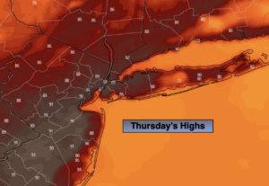
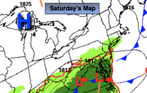
Rain will end this morning as low pressure moves offshore. It looks like the clouds will dominate much of the day form the City and to the North and East. For this reason temperatures will remain below the average high of 72º. Farther inland, some sun may shine resulting in warmer temperatures.

A warm front will move into the region on Friday. It should come through precipitation free. The latest computer guidance suggests the front may get hung up just to the South of the City. The potential for clouds dominating the day with a Southeast flow off the cooler Atlantic has increased. Due to these factors, readings will most likely be cooler than previously thought. Highs now look to be more seasonal, with warmer temperatures more like over Southern and Western regions.

By Saturday, a deep Southerly flow will develop around a Bermuda high. Readings will skyrocket to Summer-like readings under plenty of sunshine. Many areas just away from the coast will crack 90º.This pattern will continue for Sunday. Sunday may very well be the hotter of the two days for the City.

A cool front will move through the region Sunday night with scattered showers and maybe a rumble of thunder. Relief will arrive Monday behind the front under a mix of sun and clouds.

Stay tuned.

Keep it here for a no hype, no nonsense forecast.

Thursday:

Rain ending this morning. Remaining mostly cloudy. Highs in the 60s in the City and to the North and East. Warmer inland. East to West winds at 5-10mph.

Tonight:

Partly cloudy. Lows in the 50s throughout. Light and variable winds.

Friday:

Clouds, some sun. Highs around 70º in the city. Cooler at the coast, much warmer inland.

Saturday:

Mostly sunny. Hot and humid. Highs in the upper 80s to lower 90s, cooler at the coast.

Sunday:

Hazy, hot and humid.  Highs in the upper 80s to lower 90s. Cooler at the coast.

Monday:

Partly sunny. Much more comfortable.  Highs in the mid 70s.

Catch me on the Fox Weather Stream from 10am-1pm Thursday. Find us on Tubi, Roku TV and YouTube TV and as always the Fox Weather App. It’s Free!
A Winner Wednesday. Sun to Late Clouds. Comfy…


Synopsis:

Today will be a winner with sun giving way to late clouds.  Readings will be just below the average high of 72º.

A period of rain is likely tonight into Thursday morning as a weak low moves in from the West. The sun should return by afternoon on Thursday with seasonable readings.

A warm front will swing through the region on Friday. It should come through precipitation free. Temperatures will pop during the afternoon and be close to ten degrees above average.

By Saturday, a deep Southerly flow will develop around a Bermuda high. Readings will skyrocket to Summer-like readings under plenty of sunshine. Many areas just away from the coast will crack 90º.

Sunday will feature a cool front approaching the region. Morning sun will give way to mostly cloudy skies with afternoon shower and storms like. It’ll be warm and humid.

Stay tuned.

Keep it here for a no hype, no nonsense forecast.

Wednesday:

Mostly sunny. Highs around 70º. Northwest to Southwest winds at 5-10mph.

Tonight:

Rain developing. Lows in the 50s throughout. South winds at 5mph.

Thursday:

Morning showers to a mix of sun and clouds. Highs in the lower 70s.

Friday:

Partly sunny. Warmer. Highs around 80º, cooler at the coast.

Saturday:

Partly sunny. Very warm and humid. Highs in the upper 80s to lower 90s, cooler at the coast.

Sunday:

Sun and clouds. Warm and humid with scattered showers and storm during the afternoon.  Highs in well into the 80s.

Catch me on the Fox Weather Stream from 10am-1pm Wednesday. Find us on Tubi, Roku TV and YouTube TV and as always the Fox Weather App. It’s Free!
A Gem Tuesday. Bright, Mild & Breezy…


Synopsis:

A couple of gems are expected for today and Wednesday. The sun will dominate. Readings today will be several degrees above the average high of 72º. Temperatures will be more seasonable for Wednesday as high pressure moves in from the Northwest.

Showers are possible Wednesday night and Thursday morning as a weak disturbance moves in from the West. The sun should return by afternoon on Thursday.

A warm front will swing through the region on Friday. It should come through precipitation free. Temperatures will pop during the afternoon and be close to ten degrees above average.

By Saturday a deep Southerly flow will develop around a Bermuda high. Readings will skyrocket to Summer-like readings under plenty of sunshine.

Stay tuned.

Keep it here for a no hype, no nonsense forecast.

Tuesday:

Sunny, breezy and mild. Highs in the mid to upper 70s. West 10-20mph with higher gusts.

Tonight:

Clear and cool. Lows in the lower 50s in the City, the 40s inland. Northwest winds at 5-10mph.

Wednesday:

Mostly sunny. Highs around 70º.

Thursday:

Morning showers to a mix of sun and clouds. Highs around 70º.

Friday:

Partly sunny. Warmer. Highs in the upper 70s.

Saturday:

Partly sunny. Very warm and humid. Highs in the mid to upper 80s.

Catch me on the Fox Business Network from 6am-9am this weekend and on the Fox Weather Stream until Noon. Find us on Tubi, Roku TV and YouTube TV and as always the Fox Weather App. It’s Free!
Warm Monday. Sct’d PM Strong to Severe Storms…


Synopsis:

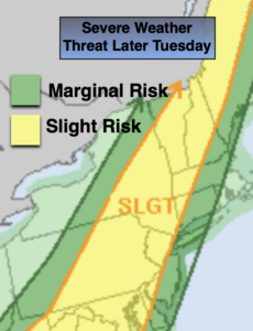
Monday will be warm ahead of a cool front. A mix of clouds and sun is expected. Showers and thunderstorms are expected during the late afternoon and evening. Some of the storms may become severe. Keep an eye to the sky for threatening weather after 4pm.

Skies will become mostly clear overnight. It’ll be a more comfortable night for sleeping.

A couple of gems are expected for Tuesday and Wednesday. A bright sky and near seasonable temperatures are expected as high pressure moves in from the Northwest.

Showers are possible Wednesday night and Thursday morning as a weak disturbance moves in from the West. The sun should return soon after on Thursday.

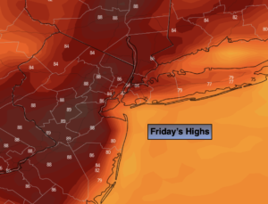
A warm front will swing through the region on Friday. It should come through precipitation free. Temperatures will pop during the afternoon and be well above the average high of 72º.

Stay tuned.

Keep it here for a no hype, no nonsense forecast.

Monday:

Sun and clouds. Warm. Afternoon showers and thunderstorms. Some of the storms maybe strong to severe. Highs in the upper 70s. South winds at 8-15mph.

Tonight:

Becoming mostly clear. It’ll be cooler than recent nights. Lows in the 50s throughout. West winds at 8-15mph.

Tuesday:

Sunny. Highs in the mid 70s.

Wednesday:

Mostly sunny. Highs around 70º.

Thursday:

Morning showers to a mix of sun and clouds. Highs around 70º.

Friday:

Partly sunny. Warmer. Highs in the upper 70s.

Catch me on the Fox Business Network from 6am-9am this weekend and on the Fox Weather Stream until Noon. Find us on Tubi, Roku TV and YouTube TV and as always the Fox Weather App. It’s Free!
Patchy AM Fog. Warmer Sunday. Clouds & Sun…


Synopsis:

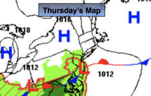
A moist Southerly flow will continue this weekend as a Western Atlantic high results in a Southerly wind. It will be humid.

Morning patchy fog and clouds will give way to some sun as the day goes on. Today will be the drier of the two weekend days. A bulb of warm, humid air will move into the region. Temperatures will be well above average by several degrees.

It’ll be muggy tonight with a few showers.

Monday will be warm ahead of a cool front. A mix of clouds and sun is expected. Showers and thunderstorms are expected during the late afternoon and evening. Some of the storms may become severe. Keep an eye to the sky for threatening weather.

Slightly cooler readings are expected for Tuesday through Thursday under a bright sky as high pressure moves in from the Northwest.

Stay tuned.

Keep it here for a no hype, no nonsense forecast.

Sunday:

Morning clouds and patchy fog giving way to some sun. Warmer. Highs in the upper 70s. South winds at 5-10mph.

Tonight:

Scattered showers. Areas of fog developing. Lows in the 60s throughout. Light South winds.

Monday:

Sun and clouds. Warm. Afternoon showers and thunderstorms. Some of the storms maybe strong to severe. Highs in the upper 70s.

Tuesday:

Sunny. Highs in the lower to mid 70s.

Wednesday:

Sunny. Highs in the lower 70s.

Thursday:

Partly sunny. Highs in the upper 60s to around 70º.

Catch me on the Fox Business Network from 6am-9am this weekend and on the Fox Weather Stream until Noon. Find us on Tubi, Roku TV and YouTube TV and as always the Fox Weather App. It’s Free!