Synopsis:
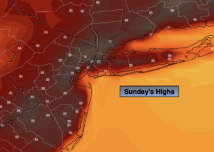
Relief from the humidity will arrive today as front pushes offshore. Any morning clouds will give way to mostly sunny skies during the afternoon. Readings will be around the average high of the mid 80s.
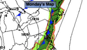
The 4th of July forecast will make most smile. Sunny skies, warm temperatures and low humidity is expected on Monday!
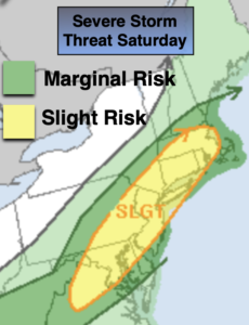
Tuesday will see any increase in humidity and temperature as a Southwest wind around a Southeast high pressure develops. Showers and storms are possible later in the day with an approaching front.
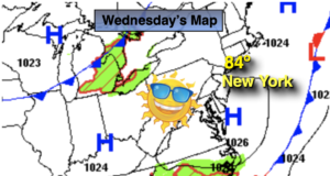
The humidity will drop on Wednesday and Thursday under plenty of sun as high pressure moves in.
Stay tuned.
Keep it here for a no hype, no nonsense forecast.
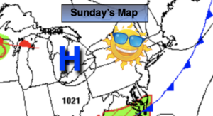
Sunday:
Morning clouds giving way to mostly sunny skies. Not as hot or humid. Highs in the mid 80s. Northwest winds at 5-10mph.
Tonight:
Clear and comfortable. Lows in the mid 60s the City, the 50s inland. North winds less than 5mph.
4th of July:
Sunny and warm. Highs in the mid 80s.
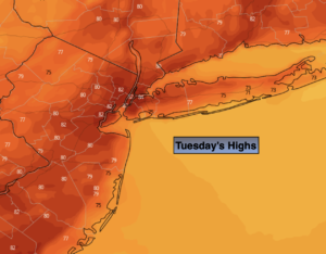
Tuesday:
Partly sunny. Scattered showers and storms possible later in the day. Highs in the upper 80s.
Wednesday:
Partly sunny. Less humid. Highs in the mid 80s.
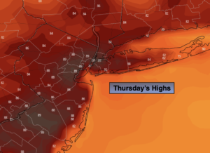
Thursday:
Partly sunny. Highs in the mid 80s.
Catch me on the Fox Business Network this weekend until 9am Weather Stream until 10am. Find us on Tubi, Roku TV and YouTube TV and as always the Fox Weather App. It’s Free!