Synopsis:
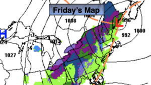
Friday and Saturday will feature more clouds than sun as the atmosphere will be unstable with an upper low over the Northeast. A spotty shower is possible today. A gusty Northwest breeze will create a nip in the air. We’ll definitely be experiencing Spring’s chilly side through the period.
Sunday will be the better half of the weekend with high pressure moving in. Readings will be more seasonable in the mid to upper 50s under abundant sunshine.
High pressure will dominate on Monday. This should provide decent viewing conditions for the solar eclipse. Mostly sunny skies are forecast with mild readings.
The mild trend will continue Tuesday as readings soar to almost ten degrees above the average high of the mid 50s.
Stay tuned.
Keep it here for a no nonsense, no hype forecast.
Friday:
Clouds and sun. Breezy. Spotty afternoon shower. Highs in the lower 50s. Northwest winds at 15-25mph with gusts to 30mph.
Tonight:
Isolated evening shower, otherwise mostly cloudy. Lows in the 30s throughout. Northwest winds at 15-25mph with gusts to 30mph.
Saturday:
Clouds and sun. Breezy. Highs in the mid 50s.
Sunday:
Mostly sunny. Milder. Highs in the upper 50s.
Monday:
Mostly sunny. Highs in the lower 60s.
Tuesday:
Partly sunny. Highs in the mid 60s.