Synopsis:
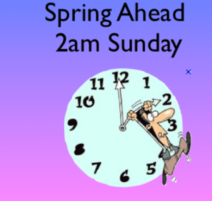
Tonight skies will become partly cloudy. We “Spring Ahead” tonight. Eastern Standard Time Ends, Daylight Saving Time begins at 2am. Don’t forget to set your clocks ahead one hour before hitting the hay. It’s also a reminder to change the batteries in your smoke and carbon monoxide detectors.
Sunday definitely will be the better half of the weekend with brighter skies and seasonable readings as high pressure influences the region. It will be a brief break, unfortunately.
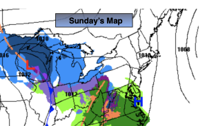
The next storm is on the map for Monday and Tuesday as low pressure develops off the coast. The potential track of the storm is above. This is a classic text book track for a heavy snowfall for our area, if all the ingredients are there. We have to remember this is mid March and many ingredients need to be perfect for a snowstorm here. The first part of the storm is straight forward. There isn’t a cold high to supply the cold air for the start of the event. For this reason, rain will develop and not snow on Monday for much of the region. Well to the North wet snow or a mix is likely.
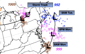
Now, this is where the fun part begins (for meteorologists anyway) for Monday night and Tuesday. The upper levels (jet stream level) will have a deepening cutoff low that will slide Southeast from the Great Lakes. At the same time surface low pressure will strengthen rapidly off the Virginia coast and move to the classic bench mark of 40º North Latitude, 70º West Longitude, South East of Montauk Point Long Island. All the models have the storm coming to a halt then doing a loop over Cape Cod or East of Long Island. Depending on where this exactly happens will determine the Western extent of the heavy snow band that will accompany the backside of the storm. This is known as the deformation zone. The area of heavy snow. As of this writing the potential for this band to reach the lower Hudson Valley and parts of CT is there for late Monday night into Tuesday. Meaning a full fledge snowstorm is possible here. Farther South into the immediate NYC vicinity, Long Island and Northern NJ it’s a big question mark at this time. Some snow is quite possible on Tuesday (rain going over to snow over the City and parts of Long Island during the morning with an accumulation. Amounts also may be cut down because of a warm fetch farther East on the Island and parts of CT. South and West of 287 in NJ may also have much lighter amounts because they maybe too far from the heavier snows. Winds will be strong with the storm.
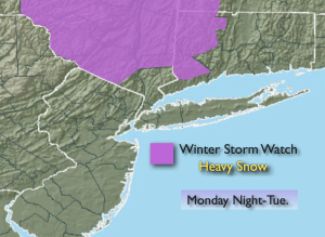
In summary, the potential has increased for a snowstorm North of NYC where the Winter Storm Watch is up. Many questions still need to be answered.
Wednesday will be bright but windy. Thursday the sun will dominate and winds will abate.
Stay tuned. Keep it here for a no nonsense, no hype forecast.
Tonight:
Becoming partly cloudy. Lows around in the mid 30s along the urban corridor, the upper 20s inland. North winds diminishing to 5-10mph.
Sunday:
Mostly sunny and breezy. Late day clouds. Highs in the mid 40s. Northeast to Southeast winds at 5mph.
Monday:
Rain developing, a mix well North. Highs in the mid 40s.
Tuesday:
Potential of snow. Heavy North. Rain, mix to snow at coast. Windy. Highs 30º-35º.
Wednesday:
Partly sunny. Windy. Highs around 40º.
Thursday:
Sunny. Mild Highs around 50º.