Synopsis:
The last day of Summer is upon us. It’ll be warm as high pressure moves to our south. Readings will be at around five degrees above the average high of 75º. Abundant sunshine is expected.
Thursday- Fall’s debut will be right on cue as significant cool front will move through the region with scattered showers during the midday hours. Readings will be near seasonable. By Friday the front will have moved offshore and allow for chilly high pressure to work in from Canada. It will every bit like Autumn with readings remaining in the 60s.
The first weekend of Fall will be delightful with plenty of sun and cool readings.
Keep it here for a no hype, no nonsense forecast.
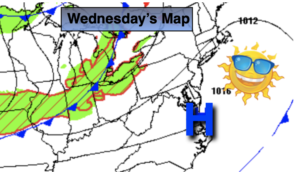
Wednesday:
Sunny. Warm. Highs around 80º. North to South winds at 5mph.
Tonight:
Partly cloudy. Lows in the 60s throughout. South to Southwest winds at 5-10mph.
Thursday:
Scattered showers, otherwise a mix of clouds and sun. Becoming breezy during the afternoon. Highs in the mid 70s.
Friday:
Partly sunny, breezy and much cooler. Highs in the mid 60s.
Saturday:
Sunny. Highs in the around 70º.
Sunday:
Partly sunny. Highs in the mid 70s.
Catch me Saturday on the Fox Business Network from 6am-9am and on the Fox Weather Stream until 10am. Find us on Tubi, Roku TV and YouTube TV and as always the Fox Weather App. It’s Free!