Synopsis:
Readings will pop to near the average high of the upper 30s to around 40º today as the bitter air of high pressure moderates and moves off the coast. It will feel like a heatwave!
Temperatures will remain above freezing tonight in urban areas for a change under mainly clear skies.
Readings will rise a few degrees more on Thursday as high pressure continues to move offshore under mainly sunny skies.
Cold conditions will return for Friday as low pressure moves well off the Eastern seaboard and a strong Northerly wind ushers in Canadian air once again.
Plenty of sun is expected for Saturday. Despite the sun, readings will only remain in the 20s!
On Sunday sun will give way to clouds. JMW is keeping an eye on a Southern Storm for Sunday Night into Monday. The potential is there for snow possibly chaining over to a mix or rain. This storm could become a nor’easter with high winds and coastal flooding. Many days to watch and digest the latest computer guidance. Don’t believe all the chatter you are hearing at this time. Stick to reliable sources.
Stay tuned..
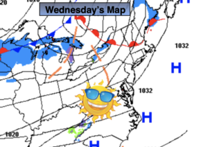
Wednesday:
Mostly sunny. Much milder. Highs around 40º. Southwest winds at 5mph.
Tonight:
Partly cloudy. Not as cold as recent nights. Lows in the lower to mid 30s in the City, the 20s inland. West winds at 5mph.
Thursday:
Partly sunny. Highs in the lower 40s.
Friday:
Mostly sunny, windy and colder. Highs in the lower to mid 30s.
Saturday:
Sunny. Very cold. Highs in the upper 20s.
Sunday:
Sun giving way to clouds. Cold. Highs around 30º.