Synopsis:
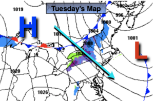
Clouds will give way to mostly sunny skies today. A gusty Northwest wind will be with us behind a strengthening Canadian Maritime storm. At least temperatures will be above average by a few degrees. The average is 41º.
Tonight will be clear and cold. Any slush or standing water will freeze.
Viewing of the Christmas Star (Jupiter and Saturn just about touching from the view from Earth) this evening, just after sunset will be visible as skies will be clear. Look in the Southwestern sky.
Wednesday will be the best weather day out of the bunch with abundant sunshine and nearly calm winds as high pressure settles along the East coast.
Christmas Eve will feature a developing deep Southerly flow ahead of a cold front and developing storm. Readings will pop into the 50s and showers are likely later in day. A shot of heavy rain and high winds are likely Late Christmas Eve into the wee hours of Christmas morning. It should dry out for Christmas Day with falling temperatures. It does not look like a White Christmas unless those of you that have deep snowpack will be able to keep it until Christmas morning.
Saturday will be sunny but cold readings will flirt with freezing.
Stay Tuned.
Keep it here for a no nonsense, no hype forecast.
Today:
Clouds to sun. Breezy. Highs in the mid 40s. West to Northwest winds at 15-25mph with higher gusts.
Tonight:
Clear and cold. Lows near freezing in the City, near 20º-30º inland. West to Northwest winds diminishing to 5-10mph.
Wednesday:
Sunny. Highs in the lower to mid 40s.
Christmas Eve:
Mostly cloudy with scattered showers by evening. Balmy. Highs in the mid 50s.
Christmas Day:
Becoming partly sunny with falling daytime temperatures. Highs in the upper 40s during the morning. Readings will fall into the 30s by late day.
Saturday:
Sunny and cold. Highs around freezing.