Synopsis:
Today will be the best weather day out of the bunch with abundant sunshine and nearly calm winds as high pressure settles along the East coast readings will be a couple of degrees above the average high of 40º.
Clouds will increase tonight. Most areas will remain above freezing. The urban corridor will be mild- above the average high for the date!
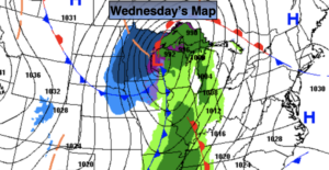
Christmas Eve will feature a developing deep Southerly flow ahead of a cold front and developing storm. Readings will pop into the 50s and scattered showers are likely later in day. The majority of the day will be dry. A shot of heavy rain and high winds are likely Late Christmas Eve into Christmas morning. It should dry out for Christmas Day with falling temperatures. It does not look like a White Christmas unless those of you that have deep snowpack will be able to keep it until Christmas morning.
Saturday will be sunny but cold readings will flirt with freezing as high pressure works in from the Northwest.
Seasonal sun is expected on Sunday.
Stay Tuned.
Keep it here for a no nonsense, no hype forecast.
Today:
Sunny. Highs in the lower to mid 40s. Northwest to Southwest winds at 5mph.
Tonight:
Increasing clouds. Mild for late December standards. Lows in the lower 40s in the City, the 30s inland. South wind at 5mph.
Christmas Eve:
Mostly cloudy with scattered showers later in the afternoon. Becoming windy. Balmy. Highs in the mid to upper 50s by evening.
Christmas Day:
Morning rain, otherwise becoming partly sunny with falling daytime temperatures. Highs in the upper 40s during the morning. Readings will fall into the mid 30s by late day.
Saturday:
Sunny and cold. Highs around freezing.
Sunday:
Sunny and seasonal. Highs near 40º.