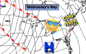
Synopsis:
Today will be cold, despite mainly sunny skies. Readings will be almost fifteen degrees below the average high of 53º. Many areas will remain in the 30s. The wind will add a bite. Winds chills will be in the 20s then rise to around freezing during the afternoon.
Clear and cold tonight. Most areas will be at or below freezing with wind going nearly calm.
A slow rebound in temperatures will begin on Thursday as high pressure slips off the coast and a Southwest wind develops. The sun will continue to dominate. By Friday readings will jump ten degrees with a milder push of air.
The weekend at this time looks bright, sunny and mild as another high pressure system influences our region.
Stay Tuned.
Keep it here for a no nonsense, no hype forecast.
Today:
Sunny, breezy and cold. Highs around 40º, the 30s inland. Afternoon wind chills near freezing. Northwest winds at 10-20mph.
Tonight:
Clear and cold. Lows around 30º in urban areas, the teens and 20s inland. Northwest winds diminishing to below 5mph.
Thursday:
Sunny. Chilly. Highs in the upper 40s.
Friday:
Sunny. Milder. Highs around 60º.
Saturday:
Sunny. Mild. Highs around 60º.
Sunday:
Mostly sunny. Mild. Highs in the upper 50s.