Synopsis:
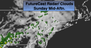
Today will be milder as high pressure slips offshore and a Southwesterly flow develops. It will be mainly cloudy. A few spotty afternoon showers are possible.
A front will work in from the west slowly Monday. Showers are possible just about any time. It’ll be warm.
High pressure will work in from the Midwest for Tuesday. Seasonal temperatures and no rain is expected at this time. An ocean low will develop in the Western Atlantic for mid to late week. The models are all over the place with its placement and track. If the storm’s rain shield moves far enough West showers or a period of rain is likely Wednesday and Thursday. This is no way etched in stone, but the potential is there. Continue to check back with JMW for the very latest.
Stay Tuned.
Keep it here for a no nonsense, no hype forecast.
Today:
Mostly cloudy and milder. A few spotty afternoon showers are possible. Highs in the upper 60s. Southeast to South winds at 8-12mph.
Tonight:
Mostly cloudy with spotty showers. Lows in the lower to mid 60s in the City throughout. South winds at 5-10mph.
Monday:
Mostly cloudy with scattered showers, best chance is later in the day and at night. Warm. Highs in the lower to mid 70s.
Tuesday:
Partly sunny. Highs in the upper 60s.
Wednesday:
Mostly cloudy. Potential for showers or a period of rain. Highs in the mid 60s.
Thursday:
Mostly cloudy. Potential for showers or a period of rain. Highs in the mid 60s.