Synopsis:
Clouds will give way to sun today as high pressure begins to influence our weather from Canada. Winds will pick up and readings will still be a several degrees above the average high of the upper 30s.
Monday will be sunny to start but clouds will roll in during the afternoon. Temperatures will finally be seasonal, reaching the mid to upper 30s. A weak low pressure system will approach Monday night. Light rain or snow showers are possible. This shouldn’t be a big deal.
Tuesday we’ll be sandwiched between the departing weak low and another weak low heading our way from the West. It’ll be mild with highs near 50º. Another shot of scattered rain and or snow showers is possible with the second low Tuesday night. This low will be followed by typical January readings as the flow will finally come out of Canada. Highs for late week will be seasonal for January. A chill is on the way, but by no means will this be an Arctic blast.
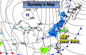
There has been chatter about a possible storm next Sunday. At this time the system looks to stay well offshore. This is 7 days away. Plenty can change, but at this time I’m keeping it dry. The wait continues snow lovers.
You know where to find a no hype, no nonsense forecast.
Stay tuned.
Today:
Clouds to sun, becoming windy. Mild. Highs in the mid to upper 40s. Northwest winds increasing to 15-30mph with higher gusts.
Tonight:
Clear and much colder than recent night. Lows in the 20s in the city, the teens inland. Northwest winds diminishing to 5-10mph.
Monday:
Sun to clouds, seasonal. Highs in the mid to upper 30s.
Tuesday:
Morning clouds. Afternoon sun. Mild. Highs around 50º.
Wednesday:
Partly sunny. Highs around 40º.
Thursday:
Partly sunny. Cold. Highs in the mid 30s.