Synopsis:
Say goodbye to the 50s and hello to temperatures that will below average into the weekend as a Northwest flow prevails and a large high moves from the central portion of the nation to the East coast. The sun will dominate through the end of the week. A welcome break from all the rain. The ground will finally get a chance to dry out.
By Sunday, all eyes will be on a Southern storm. Does it slide to our South and miss the region or does it come up the coast? At this time, the pendulum is swinging toward a miss. This is why you need to get your forecasts from reliable sources. There are many weather weenies out there that think every potential storm will be the big one around these parts. JMW is monitoring the situation for any changes in the storm track..
You know where to find a no hype, no nonsense forecast.
Stay tuned.
Today:
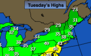
Mostly sunny, colder. Highs in the lower 40s. Northwest winds at 10-20mph.
Tonight:
Mostly clear. Much colder than recent nights. Lows in the upper 20s in the City, the teens and 20s inland. Northwest winds at 5-10mph.
Wednesday:
Partly sunny and cold. Highs in the upper 30s.
Thursday:
Partly sunny and cold. Highs in the upper 30s.
Friday:
Mostly sunny and cold. Highs in the upper 30s.
Saturday:
Mostly sunny and cold. Highs in the mid 30s.
Keep it here for a no nonsense, no hype forecast.