Synopsis:
The front that was responsible for the weekend washout will finally push off the coast today. A spotty shower can’t be ruled out this morning. The sun will return this afternoon.
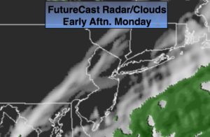
High pressure will move in for the beginning of the week with dry, sunny conditions. More seasonal readings are expected.
There is no threat of snow this upcoming workweek. The pattern is garbage for snow lovers. In fact, a balmy Southwest flow will develop around strong high pressure off the Southeast coast. It’ll be a Spring preview around here by Thursday.
A front will slip to our South by Friday ending the well above average temperatures by next weekend.
Stay tuned.
Today:
Clouds with spotty morning showers. The sun will return this afternoon. Highs in the mid 40s. Northwest winds at 8-12mph.
Tonight:
Mostly clear and much colder. Lows in the upper 20s in the City, the teens inland. Northwest winds at 8-12mph.
Tuesday:
Sunny. Highs around 40º.
Wednesday:
Partly sunny. Mild. Highs around 50º.
Thursday:
More clouds than sun. Chance of showers. Balmy. Highs in the upper 50s.
Friday:
Mostly cloudy. Chance of showers. Mild. Highs in the upper 40s. Falling temperatures are expected during the afternoon.
Keep it here for a no nonsense, no hype forecast.