Synopsis:
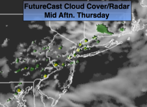
High pressure moving off the coast will result in a Southerly flow and more clouds for today. A stray storm can’t be ruled out by afternoon. Low pressure developing over the Ohio Valley will move East and off the coast Friday afternoon through Saturday morning. Parts of our region will receive heavy rain. Where the heavy rain falls is not etched in stone as the models are still in disagreement. 1″-3″ is possible in the swath of heavy rain.
The weekend at this point looks to start wet with low pressure moving offshore. The sun should return by Saturday afternoon and Sunday will be the better half of the weekend with bright skies and warm readings.
Stay tuned.
Today:
More clouds than sun. A stray storm is possible later in the afternoon. Highs around 80º. South to Southwest winds at 5-10mph.
Tonight:
Spotty storms early otherwise, mostly cloudy. Becoming muggy. Lows in the lower 70s in the City, the 60s inland. South to Southwest winds at 5mph.
Friday:
Clouds and sun. Humid. Scattered showers and storms possible by late afternoon, especially South and West of the City. The rain maybe heavy at times at night. Highs around 80º.
Saturday:
Threat of morning rain otherwise, becoming partly sunny. Highs around 80º.
Sunday:
Partly sunny. Highs in the lower 80s.
Monday:
Partly sunny. Highs in the mid 80s.
Keep it here for a no nonsense, no hype forecast.