Synopsis:
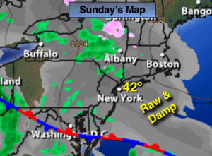
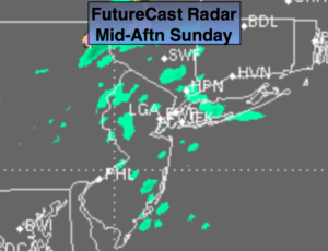
A stationary front will be to our South today. It’ll be grey with on and off light rain and drizzle. FutureCast Radar shows the spotty nature of the precipitation, map above. There will be dry times. Not a lot of rain will fall but with the wind off the cold Atlantic it’ll be raw with highs well below average.
Unsettled times will be with us Monday and Tuesday with a series of low pressure systems affecting the tri-state area. At least temperatures will moderate.
It’ll finally dry out by Wednesday.
Stay Tuned.
Today:
Cloudy with on and off light rain and drizzle. Much colder. Highs in the lower 40s. East 10-15mph.
Tonight:
Cloudy with areas of light rain and drizzle. Patchy fog. Steady temperatures. Lows in the upper 30s and lower 40s. East wind at 5-10mph.
Monday:
Scattered showers. Milder. Highs in the mid 50s.
Tuesday:
Mostly cloudy with showers possible. Warmer. Highs in the lower 60s.
Wednesday:
The sun returns. Highs in the upper 50s.
Thursday:
Partly sunny, seasonal. Highs in the lower 50s.
Stay Tuned.
Keep it here for a no nonsense, no hype forecast.