Synopsis:
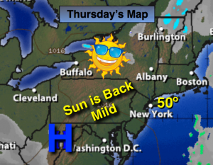
High pressure will move into the region today. The sun will finally return along with mild readings. A weak warm front will throw clouds are way for Friday with showers moving in during the afternoon.
The weekend looks to be a 50/50 split. Saturday will be the better of the two days with a decent amount of sun and once again mild readings. Clouds will dominate on Sunday and rain is likely by mid-afternoon.
A large storm will affect the Eastern Seaboard later Sunday, Monday and into a part of Tuesday. Heavy rains and highs winds are possible. Like many of the storms this season mild air will be brought up from the Gulf and Southeast coast as the systems stays inland. A more Winter-like pattern looks to be in the cards for the end of January and into February. Stay Tuned.
Today:
Mostly sunny, Mild. Highs around 50º. Northwest wind at 5mph.
Tonight:
Partly cloudy. Lows in the upper 30s in the City, the 20s inland. North wind at 5mph.
Friday:
Sun will give way to clouds. Late day showers are possible. Highs in the mid 40s.
Saturday:
Partly sunny and mild. Highs around 50º
Sunday:
Morning sun will give way to clouds. Late day showers are possible. Highs in the mid 40s.
Monday:
Rain, heavy at times. Windy. Highs in the mid to upper 40s.
Stay Tuned.
Keep it here for a no nonsense, no hype forecast.