Synopsis:
Cold high pressure will sit over the area today. Sunny and unseasonably chilly readings are expected. The next threat of rain comes Thursday as a weak area of low pressure moves in from the Ohio Valley. It maybe just cold enough well inland for a mix of sleet and snow to fall at the onset Thursday afternoon. No major accumulations are expected. Tranquil weather will close the week and mild push is on the way for the weekend.
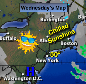
Today:
Mostly sunny. Unseasonably cool. Highs around 50º. Northwest wind at 10-15mph.
Tonight:
Mostly clear early with increasing clouds overnight. Lows around 40º in the City, the mid to upper 20s inland. Northwest to Northeast wind at 5mph.
Thursday:
Cloudy with rain developing by afternoon. The rain may start off as a mix of sleet and snow for a time Well North of the City. Highs in the 40s inland the lower 50s.
Friday:
Mostly sunny. Highs in the mid 50s.
Saturday:
Partly sunny and more seasonal with readings around 60º.
Sunday:
Partly sunny and mild. Highs in the mid 60s.
Stay Tuned.
Keep it here for a no nonsense, no hype forecast.