Synopsis:
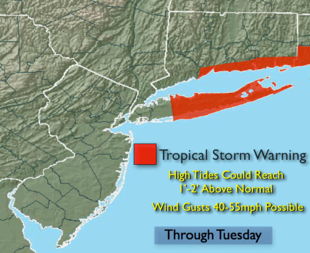
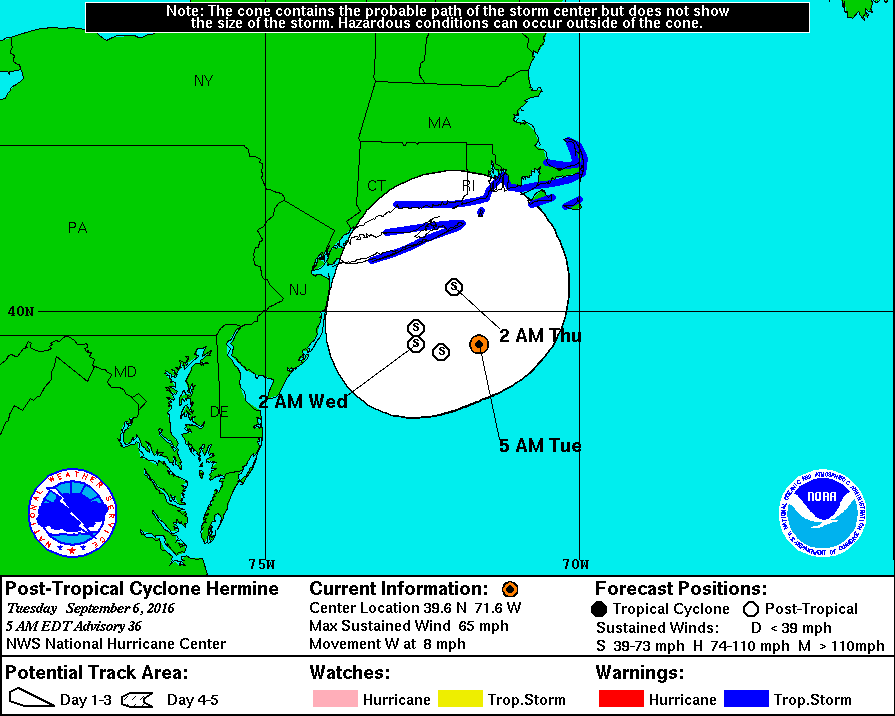
Post Tropical Storm Hermine will continue to move toward the West/Northwest today and begin to weaken. A Tropical Strom Warning remains in effect for Suffolk county and parts of coastal Connecticut for winds that may reach 40+mph in the next 24 hours. Coastal flooding at the time of high tide will occur in those areas prone to flooding. The water may reach one to two feet above normal.
High surf, dangerous rip currents and beach erosion will be an issue at our local beaches.
A mix of sun and clouds is expected for back to school and work. A few spotty showers can’t be ruled out at the coast. It’ll be warm. Hermine will move farther offshore midweek and a weak area of high pressure will develop over the Southeast by late week. This high will pump up late Summer heat. With readings reaching 90º with higher humidity.
Today:
Partly sunny and breezy, a passing shower is possible along the coast. Windy at the coast. North wind at 10-20mph with gusts to 35+mph at the coast. Highs in the lower to mid 80s.
Tonight:
Partly cloudy. Lows around 70 in the City, the mid 60 inland. A few passing showers can’t be ruled out over Long Island and at the coast. North wind 10-20mph with gusts to 35+mph at the coast.
Wednesday:
Mostly sunny with highs in the mid to upper 80s.
Thursday:
Hazy, hot and humid with highs in the upper 80s.
Friday:
Hazy, hot and humid with highs around 90º.
Saturday:
Hazy, hot and humid with highs around 90º.
Stay Tuned.
Keep it here for a no nonsense, no hype forecast.