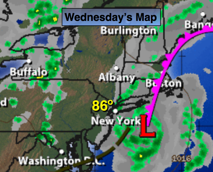
Synopsis:
The remnants of Hermine (just like an unwanted houseguest) will meander off the NJ coast for the next 24 hours. Gusty winds and a few showers are possible along the coast through this morning. High surf and dangerous rip currents will continue through midweek.
An area of high pressure will develop over the Southeast by late week. This high will pump up a hot airmass. The potential of a late Summer September heat wave exists with readings flirting with 90º and high humidity Thursday through Saturday.
Today:
Sun & clouds. A spotty shower is possible along the coast. Warm with highs in the mid 80s. North wind at 10-20mph.
Tonight:
Partly cloudy. Lows in the lower 70s in the City, the mid 60 inland. North wind diminishing to 5-10mph.
Thursday:
Hazy, hot and humid with highs near 90º.
Friday:
Hazy, hot and humid with highs around 90º.
Saturday:
Hazy, hot and humid with highs around 90º.
Sunday:
Partly sunny and less humid with highs in the mid 80s.
Stay Tuned.
Keep it here for a no nonsense, no hype forecast.