Synopsis:
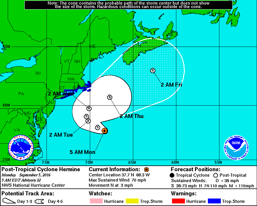
Post Tropical Storm Hermine did it’s own thing. What was supposed to be a track somewhat closer to the coast turned into a more offshore solution. This spared the region of major coastal flooding and highs winds. Yes, the forecast was a bust. When I bust; I’ll always fess up.
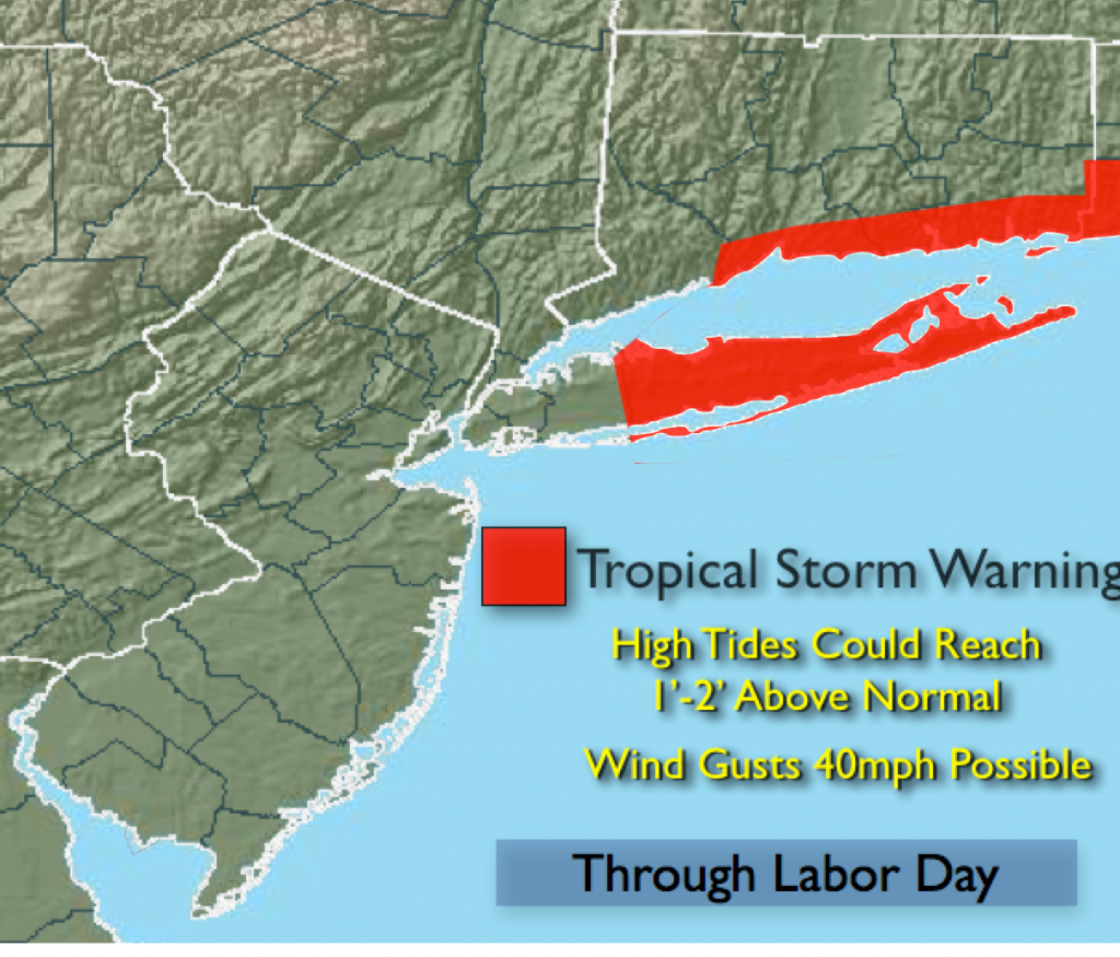
A Tropical Strom Warning remains in effect for Suffolk county and parts of coastal Connecticut for winds that may reach 40+mph in the next 24 hours.
Coastal flooding at the time of high tide will occur in those areas prone to flooding. The water may reach one to two feet above normal.
High surf, dangerous rip currents and beach erosion will be an issue at our local beaches.
Expect mainly cloudy skies at the coast with a mix of sun and clouds the farther inland you go for Labor Day.
Hermine will move farther offshore midweek. It will feel every bit like Summer with highs in the 80s then reaching 90º with higher humidity late week.
Labor Day:
Sun and clouds. Windy. Highs in the lower to mid 80s. North wind at 15-25mph with gusts to 40mph at the coast.
Tonight:
Partly cloudy. Lows in the upper 60s in the City, the mid 50s inland. Northeast to North wind 10-20mph with gusts to 35mph at the coast.
Tuesday:
Partly sunny and breezy. Highs in the mid 80s.
Wednesday:
Mostly sunny with highs in the mid to upper 80s.
Thursday:
Hazy, hot and humid with highs around 90º.
Friday:
Hazy, hot and humid with highs around 90º.
Stay Tuned.
Keep it here for a no nonsense, no hype forecast.