Synopsis:
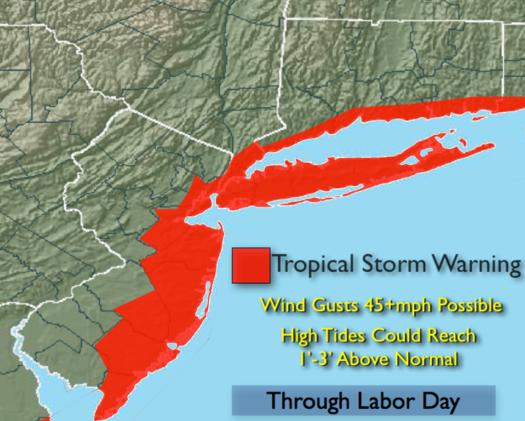
A Tropical Storm Warning is in effect for the entire coast including New York City and vicinity, Long Island and coastal Connecticut through Labor Day. Wind gusts of 30-45 mph are possible during this time. It won’t be windy all the time. The winds will be much lighter inland. This storm isn’t a rainmaker but i’ll be keeping my eye on the Western rain bands offshore. They may make it to parts of the coast for a time Monday. A mix of sun and clouds is the forecast through the holiday. The gusty winds and coastal flooding continues to be the threat with Hermine.
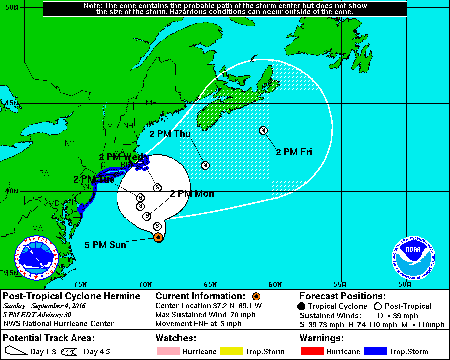
The latest track and most models have the storm slightly farther offshore through Tuesday. The track needs to be monitored as a deviation toward the coast could create a more severe situation. The storm will slow down and possibly stall or do a loop. We will go through many high tide cycles with the storm effecting the area- not good. Coastal flooding is likely during high tide with levels of 1 to possibly 3 feet above normal. If you live in an area to that is proned to coastal flooding now is the time to prepare.
High surf, dangerous rip currents and beach erosion will be an issue at our local beaches.
Tonight:
Partly cloudy. Lows in the lower to mid 60s in the City, the mid 50s inland. Northeast to North wind 10-20mph with gusts to 35mph at the coast.
Labor Day:
Sun and clouds. Windy. Highs in the lower to mid 80s. North wind at 15-30mph with gusts to 45mph at the coast.
Tuesday:
Partly sunny and breezy. Highs in the mid 80s.
Wednesday:
Mostly sunny with highs in the mid to upper 80s.
Thursday:
Hazy, hot and humid with highs around 90º.
Friday:
Hazy, hot and humid with highs around 90º.
Stay Tuned.
Keep it here for a no nonsense, no hype forecast.