Synopsis:
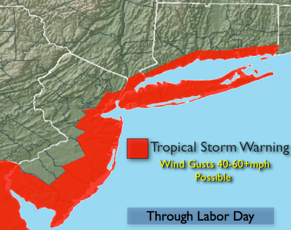
A Tropical Storm Warning is in effect for the entire coast including New York City and vicinity, Long Island and coastal Connecticut for Sunday through at least Labor Day. Wind gusts of 40-60+mph are possible during this time. It won’t be windy all the time. The winds will be much lighter inland.
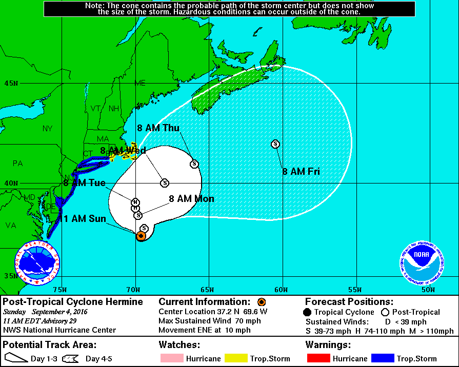
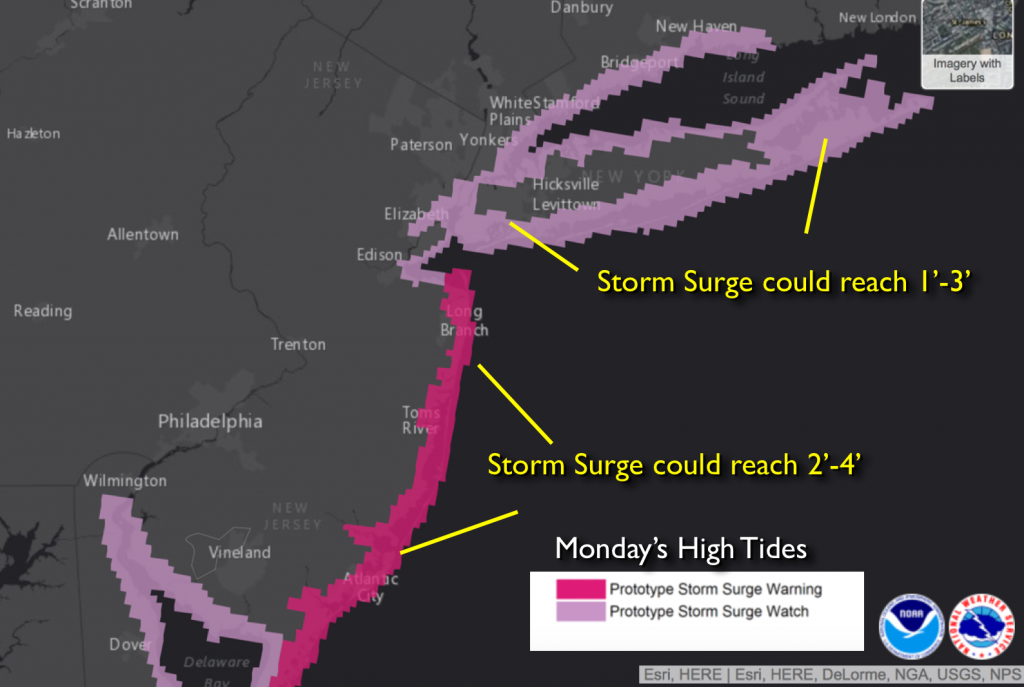
The latest track and most models have the storm slightly farther offshore through Tuesday. If this pans out the chance of rain along the coast has diminished, peak winds won’t be quite as strong and the surge won’t be quite as high. Moderate to major coastal flooding is still expected. Please DO NOT LET YOUR GUARD DOWN. Hermine continued on it’s East Northeast track for a longer time, keeping the storm when it does make the turn to the North and Northeast, farther offshore. This is the reasoning of the slightly less severe forecast. The track needs to be monitored as a deviation toward the coast could create a more severe situation. The storm will slow down and possibly stall or do a loop. We will go through many high tide cycles with the storm effecting the area- not good. Coastal flooding and a surge during high tide of 1 to possibly 4 feet is possible for tonight’s and Monday’s high tide cycle, map above (the surge is not etched in stone at this time). Now is the time to prepare.
Will the bands of rain make it to the coast and inland. It’s possible. The best chance of rain is later Sunday Night through Labor Day, especially at the coast. There will be times of sun as well.
My main concern with this storm since the beginning was the coastal flooding. It is a coastal issue and not an inland situation.
High surf and dangerous rip currents will be an issue at our local beaches. Please swim by guarded areas and heed the life guards warnings.
Today:
Sun and clouds with a slight chance of showers over South coastal later today, becoming windy. Northeast wind at 15-25mph with gusts to 30mph at the immediate coast. Highs in the 70s.
Tonight:
Partly cloudy. Showers are possible at the coast. Lows in the mid 60s in the City, the mid 50s inland. Northeast wind 15-25mph with gusts to 40mph at the coast.
Labor Day:
Mostly cloudy with areas of showers possible at the coast. Very windy. Tropical Storm conditions are possible along the coast. Highs in the mid to upper 70s.
Tuesday:
Mostly cloudy in the morning with a few showers then becoming partly sunny. Windy. Highs in the lower 80s.
Wednesday:
Mostly sunny with highs in the mid 80s.
Thursday:
Hazy, hot and humid with highs around 90º.
Stay Tuned.
Keep it here for a no nonsense, no hype forecast.