Synopsis:
A cool front will through the region today with showers(not a big event whatsoever). We are in need of rain as many areas from the NYC vicinity and Long Island are in a moderate to severe drought. A refreshing airmass will move in tonight through Saturday.
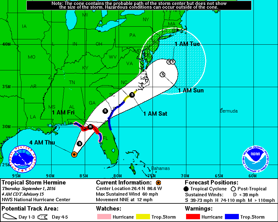
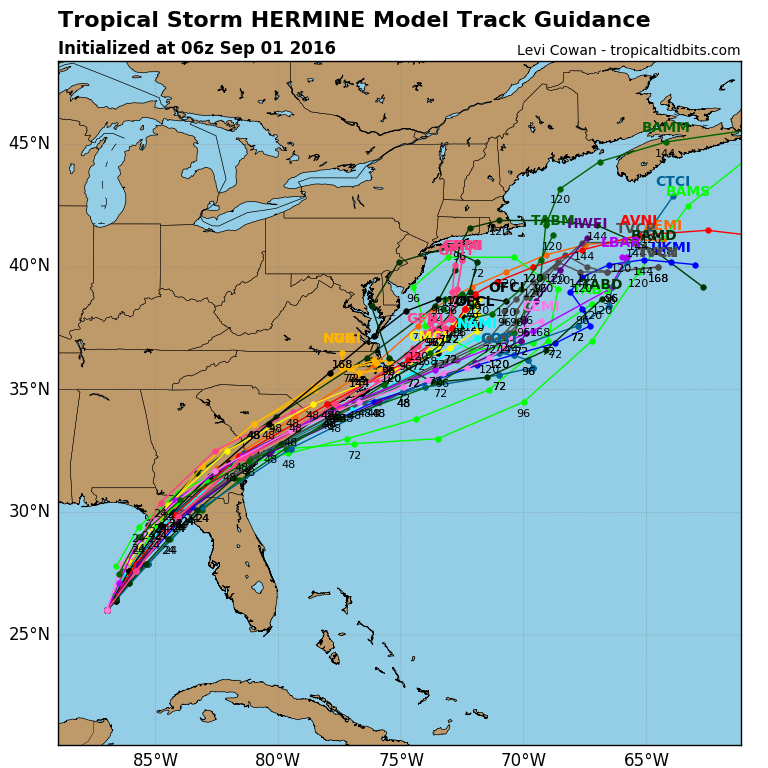
Now to Tropical Storm Hermine. The storm continues to strengthen in the Gulf of Mexico and should be a hurricane by the time it makes landfall late Thursday night in the region of the big bend of Florida. A hurricane warning has been issued for this area. Most of the computer guidance is very similar in the Hermine’s track and intensity through the Labor Day Weekend. Upper level energy diving out of the Great Lakes within a large ridge of high pressure wants to capture Hermine and keep it close to the coast and slow it down. Where will the storm actually stall and possibly do a loop? Will it be to0 far off the coast to affect the area with rain and wind or will the storm be close enough to affect the area? There are two graphics above with tracks. The first is the National Hurricane Center Track has now shifted farther offshore. The second is the spaghetti plots (10-15 computer model tracks) which is similar to NHC’s output. Both of these products suggest minor effects from the storm. High surf and beach erosion is likely as the storm will take a couple of days to leave the Western Atlantic. I am not sold on this track, yet. A difference of 200 miles in the track could mean the difference between tropical storm force winds and heavy rain or little in the way of hazardous weather in our region. Again, the time frame is Sunday into Monday. Stay Tuned.
High surf and dangerous rip currents will be an issue at our local beaches. Please swim by guarded areas and heed the life guards warnings.
Today:
Cloudy with scattered showers. Some afternoon sun is possible. Highs around 80º. North to Northeast wind at 8-12mph.
Tonight:
Becoming mostly clear and much less humid. Lows in the mid 60s in the City, the mid 50s inland. North wind at 5-10mph.
Friday:
Mostly sunny and cooler with readings in the upper 70s to around 80º.
Saturday:
Morning sun, afternoon clouds. Highs near 80º.
Sunday:
Mostly cloudy with a period of rain and wind possible. Highs in the mid 70s.
Labor Day:
Mostly cloudy with showers possible. Highs around 80º
Stay Tuned.
Keep it here for a no nonsense, no hype forecast.