Synopsis:
High pressure will continue to influence our weather on today. A cool front will move in tonight and Thursday with showers and possible storms (not a big event whatsoever). We are in need of rain as many areas from the NYC vicinity and Long Island are in a moderate to severe drought. A refreshing airmass will move in late week. At this point the Labor Day Holiday Weekend looks like a two thumbs forecast.
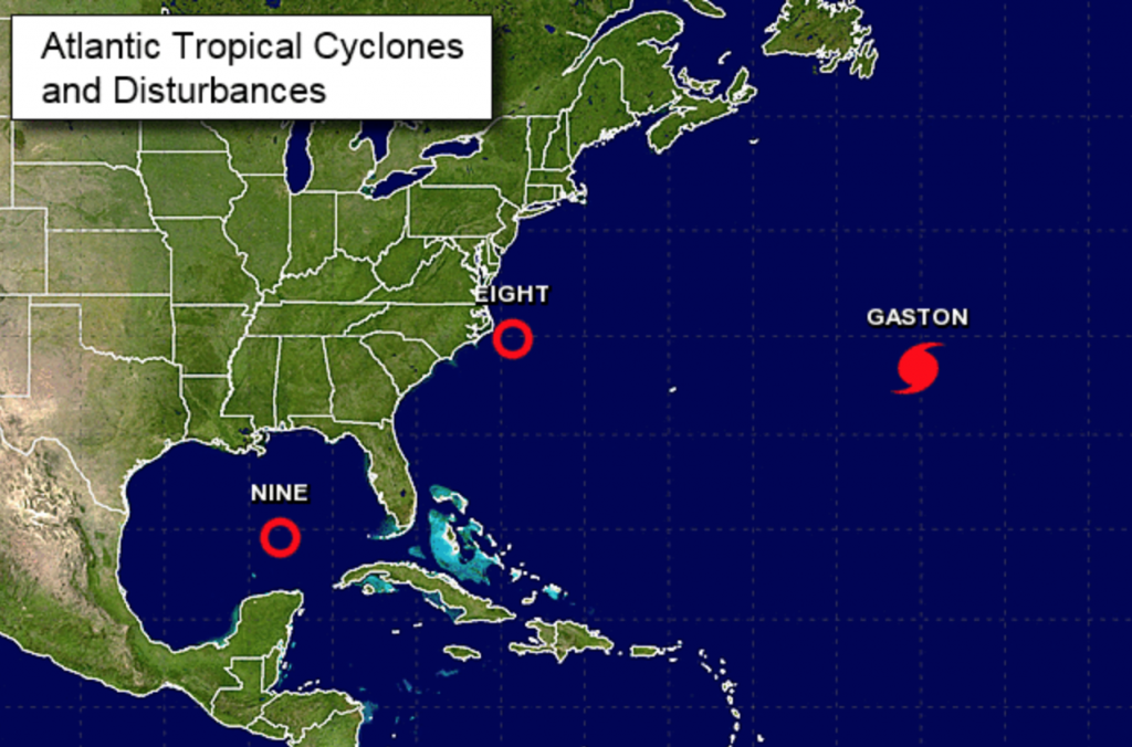
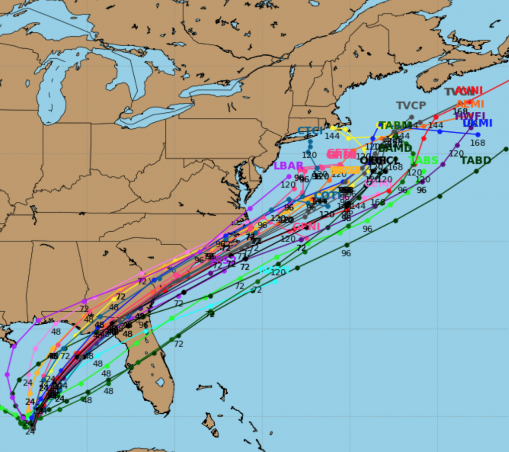
Now to the tropics. Tropical Depression #8 is East of the Carolinas and Tropical Depression #9 is in the Central Gulf of Mexico. Both of these systems are expected to become tropical storms in the next day or so. TD #8 is moving away from the Outer Banks of North Carolina and out to sea. TD #9 is likely to become a tropical storm as well and head toward the big bend of Florida. Because TD 9 is expected to have winds close to hurricane strength, a hurricane watch has been issued for the Big Bend of Florida. This storm should not affect our forecast area. But, please continue to monitor the situation as a few models want to slow the storm and meander it off the coast later in the Labor Day Weekend. At this time I’m going with a more offshore solution (spaghetti track plots above). Stay Tuned.
Gaston continues to flirt with major hurricane status (winds of 120mph). Gaston is moving Northeast through the Central Atlantic. This will be a storm for the fish and shipping lanes.
Please stay tuned to this site as the next 12 days will be active in the tropics.
High surf and dangerous rip currents will be an issue at our local beaches. Please swim by guarded areas and heed the life guards warnings.
Today:
Sun and clouds, more humid. Highs in the upper 80s. West to Southwest wind at 8-12mph.
Tonight:
Mostly cloudy with scattered showers developing toward midnight. Lows around 70º in the City, the mid 60s inland. Southwest wind at 5mph.
Thursday:
Clouds and sun with scattered showers, especially during the first half of the day. Much less humid. Highs in the lower 80s.
Friday:
Mostly sunny and cooler with readings in the mid to upper 70s.
Saturday:
Mostly sunny. Highs near 80º.
Sunday:
Mostly sunny. Highs near 80º.
Stay Tuned.
Keep it here for a no nonsense, no hype forecast.