Synopsis:
High pressure will continue to influence our weather for much of the week. We are in need of rain and a bit may fall later this week. A cool front will move in Wednesday night and Thursday with showers and possible storms (not a big event whatsoever). A refreshing airmass will move in late week. At this point the Labor Day Holiday Weekend looks like a two thumbs forecast.
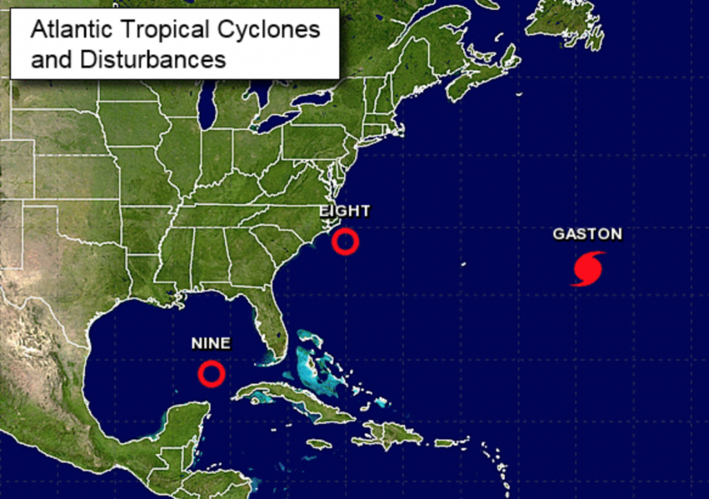
Now to the tropics. Tropical Depression #8 is East of the Carolinas and Tropical Depression #9 is in the Southeast Gulf of Mexico. Both of these systems are expected to become tropical storms in the next day or so. TD #8 may affect the Outer Banks of North Carolina later this week as a tropical storm. TD #9 is likely to become a tropical storm as well and head toward the big bend of Florida. The names of the storms depending on which one becomes a tropical storm first will be Hermine and Ian. Gaston has backed off from major hurricane intensity and is now a category 2 storm. Gaston has turned to the Northeast and will continue to head through the central Atlantic. This will be a storm for the fish and shipping lanes (refer to map above). Please stay tuned to this site as the next 14 days will be active.
High surf and dangerous rip currents will be an issue at our local beaches. Please swim by guarded areas and heed the life guards warnings.
Today:
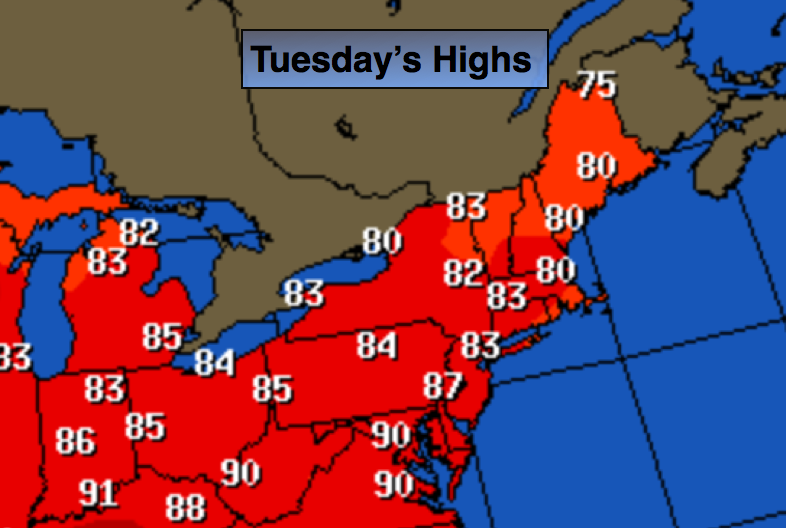
Mostly sunny and more comfortable. Highs in the mid 80s. Northeast to Southeast wind at 5-10mph.
Tonight:
Mostly clear. Lows around 70º in the City, near 60º inland. South to Southwest wind at 5mph.
Wednesday:
Partly sunny. Highs in the upper 80s.
Thursday:
Clouds and sun with scattered showers, especially during the first half of the day. Much less humid. Highs in the lower 80s.
Friday:
Mostly sunny and cooler with readings in the mid to upper 70s.
Saturday:
Mostly sunny. Highs near 80º.
Stay Tuned.
Keep it here for a no nonsense, no hype forecast.