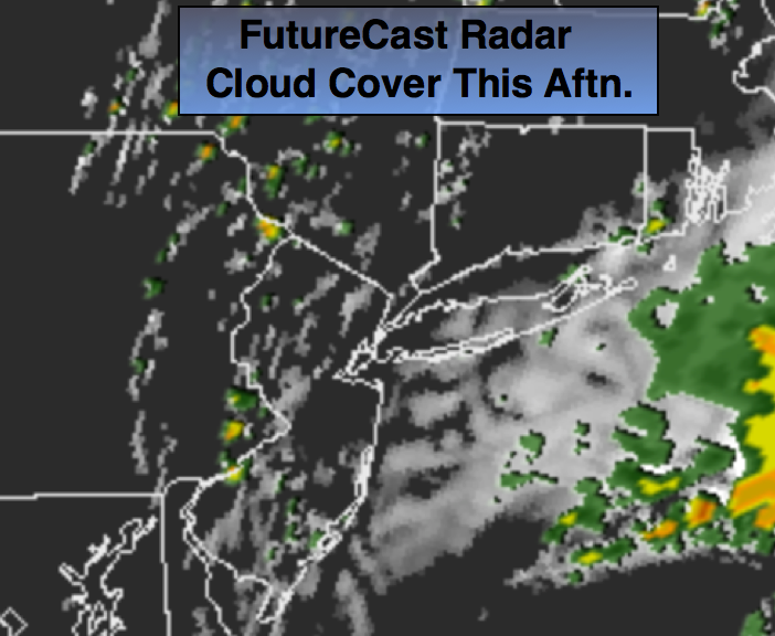
Synopsis:
The heat wave has come to an end. An area of low pressure moving through the region this morning will cause periods of rain and possibly a thunderstorm. The rain maybe heavy at times by the coast. The rain will taper off from West to East during the mid-day hours. The good news here is that the torrential rain that could of caused significant flooding doesn’t look to be materializing. Local roadway flooding is possible this morning where the heaviest rain falls but widespread flooding is not expected. In fact, the sun will return for the second half of the day-FutureCast cloud cover and radar shows clearing skies (map above).
The weekend forecast will be hit or miss with showers and storms as another low pressure system moves in. It will not be a washout.
Today:
Periods of rain this morning. Some of the rain maybe heavy for a time by the coast. The rain and storms should taper off around mid-day. Afternoon sun is possible. Cooler, but still humid. Highs in the lower 80s. A spot afternoon storm is possible. North Northeast wind at 10-20mph with higher gusts in the afternoon.
Tonight:
Partly cloudy and muggy. Lows in the lower to mid 70s in the City, mid to upper 60s inland. Light and variable winds.
Saturday:
Hazy, very warm and humid. A spotty afternoon storm is possible mainly West of the City. Highs in the mid 80s.
Sunday:
Mainly cloudy and humid with the chance of scattered showers and storms. Highs around 80º.
Monday:
Partly sunny with highs in the lower 80s.
Tuesday:
Mostly sunny with readings in the mid 80s.
Stay Tuned.
Keep it here for a no nonsense, no hype forecast.