Synopsis:
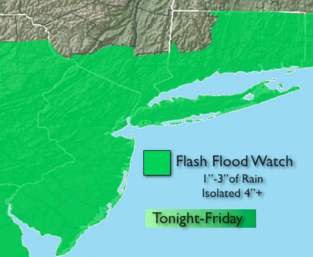
The heat wave will come to an end but we’ll pay the price. A round of heavy rain and thunderstorms is expected tonight into mid-day Friday. Some of the rain will be torrential. A Flash Flood Watch is in effect for the entire area through Friday. One to three inches of rain is possible with local amounts of 4″+ not out of the question. If you encounter a flooded roadway TURN AROUND, DON’T DROWN. The atmosphere is prime for locally heavy rain with a higher moisture content in the atmosphere combined with very warm air and a disturbance moving in.
The weekend forecast is looking like a 50/50 split with Saturday being the better of the two days. Another low will affect the region on Sunday with scattered showers and storms.
Tonight:
Cloudy with rain and thunderstorms developing. The rain could be heavy at times. Southeast wind at 5mph.
Friday:
Periods of rain and thunderstorms. The rain could be heavy at times in the morning. The rain and storms should taper off around mid-day. Afternoon sun is possible. Cooler, but still humid. Highs in the lower 80s. North Northeast wind at 10-20mph with higher gusts in the afternoon.
Saturday:
Hazy, very warm and humid. A spotty afternoon storm is possible mainly West of the City. Highs in the mid 80s.
Sunday:
Mainly cloudy and humid with the chance of scattered showers and storms. Highs around 80º.
Monday:
Partly sunny with highs in the lower 80s.
Tuesday:
Mostly sunny with readings in the mid 80s.
Stay Tuned.
Keep it here for a no nonsense, no hype forecast.