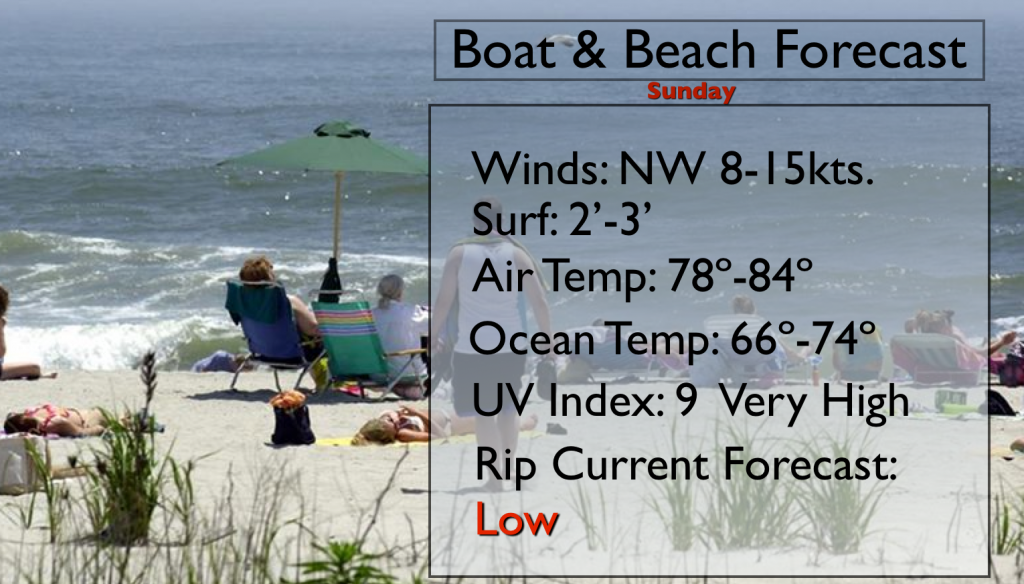
Synopsis:
An upper low over New England may pinwheel some energy into the region resulting in isolated afternoon showers. Much of the day will be dry with a mix of sun and clouds. It’ll definitely be the better half of the weekend with much lower humidity.
Looking down the pike, the heat will return mid to late week next week.
Today:
A mix of sun and clouds. Less humid. Isolated showers are possible during the afternoon. Most areas will remain dry. Northwest wind at 10-20mph.
Tonight:
Mostly clear and comfortable. Lows in the upper 60s in the city, the lower 60s inland. Northwest wind at 5-10mph.
Monday:
Mostly sunny with low humidity. A July gem. Highs in the lower 80s.
Tuesday:
Another winner. Mostly sunny. Highs in the mid 80s.
Wednesday:
Partly sunny and more humid. Highs around 90º.
Thursday:
Hazy, hot and humid with readings in the lower 90s. Scattered storms are possible during the afternoon.
Keep it here for a no nonsense, no hype forecast.