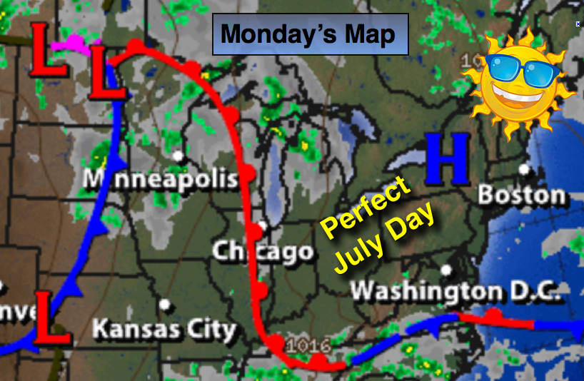
Synopsis:
High pressure will dominate our region through midweek resulting in mostly sunny skies. Temperatures and humidity levels will be tolerable through Tuesday. Typical July conditions will return mid to late week as a hot bubble of air works in from the South and West. Readings will be near or above 90º with high humidity.
Today:
A July Gem. Mostly sunny with low humidity. Highs will be in the lower 80s. North to Southeast wind at 5-10mph.
Tonight:
Mostly clear and comfortable. Lows in the upper 60s in the city, the lower 60s inland. South/Southwest wind under 5mph.
Tuesday:
Mostly sunny with seasonal readings. Highs in the mid 80s.
Wednesday:
Partly sunny, warmer and slightly more humid. Readings will be in the upper 80s.
Thursday:
The 3 H’s are back. Temperatures will be around 90º with scattered afternoon storms.
Friday:
Hazy, hot and humid with readings in the lower 90s.
Keep it here for a no nonsense, no hype forecast.