Synopsis:
A warm and progressively more humid airmass will be over the region through Tuesday. A cool front moving into the East may spark off a late day isolated storm North and West today. A better chance of showers and storms will occur on Tuesday as the front moves in. High pressure will build in for late week.
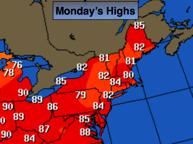
Today:
Partly sunny, warm and more humid with highs in the mid 80s. Isolated thunderstorms are possible later in the day North and West of the City. South wind at 10-20mph.
Tonight:
Mostly cloudy and muggy. Scattered showers and thunderstorms are possible Lows around 70º in the City, the mid 60s inland. South wind less than 5mph.
Tuesday:
Mostly cloudy and not as warm. The humidity will be high. Scattered showers and thunderstorms are likely just about anytime. Highs in the upper 70s to around 80º.
Wednesday:
A morning shower East, otherwise partly sunny with lowering humidity during the afternoon. Highs in the lower 80s.
Thursday:
Mostly sunny and warm for June’s finale. Readings will be in the mid 80s.
Friday:
Partly sunny for July 1st. Highs in the mid 80s.
Stay Tuned.
Keep it here for a no nonsense, no hype forecast.