Synopsis:
The weather should make most dads smile today- Father’s Day. A dry Northwest flow will result in abundant sunshine and seasonable readings! Average highs are around 80º.
Much of next week looks stellar as high pressure builds over the Northeast. Plenty of sunshine and near seasonable readings can be expected. It’ll be slightly cooler by a few degrees midweek, but readings will warm by Thursday. A fine stretch of late June conditions for sure!
Stay tuned.
Keep it here for a no nonsense, no hype forecast.
Father’s Day:
Mostly sunny. Seasonable. Highs in around 80º. Northwest winds at 8-12mph.
Tonight:
Mostly clear. Lows in the mid 60s in the City, the 50s inland. Northeast winds at 5mph.
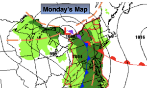
Monday:
Mostly sunny. Highs around 80º.
Tuesday:
Mostly sunny. Slightly cooler. Highs in the mid 70s.
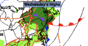
Wednesday:
Mostly sunny. Highs in the mid 70s.
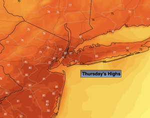
Thursday:
Mostly sunny. Milder. Highs around 80º.