Synopsis:
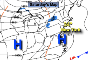
The weather pattern for the end of February into the first few days of March will be tranquil. There are no storms on the map. A few cold fronts will pass through along with areas of high pressure. It’s basically a wash, rinse and repeat.
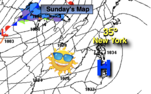
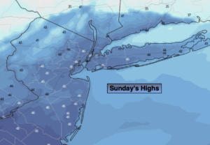
Sunday will feature a mix of sun and clouds. Highs will be a couple degrees above the average high is 45º. The wind will be busy.
A cold front will move through tonight with a gusty wind and colder temperatures.
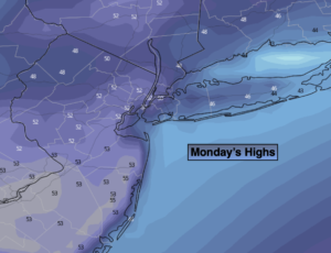
Monday will feature readings remaining around freezing despite the sunshine. The wind will add a bite, especially in the morning.
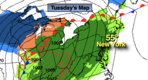
March will come in like a lamb on Tuesday. It won’t be as harsh under a mix of sun and clouds. High pressure will dominate midweek with near seasonal readings.
Stay tuned.
Sunday:
Partly sunny and milder. Breezy. High in the mid 40s. West winds at 15-25mph with gusts to 30mph.
Tonight:
Clear, breezy and cold. Lows in the mid 20s in the City, the teens and 20s inland. Northwest winds at 15-25mph.
Monday:
Sunny. Quite cold. High near freezing.
Tuesday:
Mostly sunny. High in the mid 40s.
Wednesday:
Partly sunny. High in the mid to upper 40s.
Thursday:
Mostly sunny. High around 40º.