Spring-like Saturday…


Synopsis:

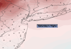
Our Spring preview (day 3) will continue today as high pressure dominates over the Southeast. Bright, mild and tranquil conditions are expected. Temperatures will be well above the average high of 40º.

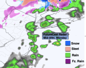
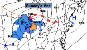
This evening, a cold front will swing through. We’ll be back to reality with Winter. An area of low pressure will develop on the offshore front. It looks to yield a period of light snow. The snow will start late tonight and continue into midday Sunday. The greatest chance of a coating up to two inches will be from the I-95 corridor and to the coast. Well inland it may not flake at all.

Temperatures on Sunday will be well below the average high of 42º; it’ll actually be around freezing. It will be a shock after our warm spell.

Monday will be very cold with readings remain in the 20s as Arctic high pressure dominates.

By Tuesday many areas should approach or crack freezing under sunny skies.

Stay tuned.

Saturday:

Clouds and sun. Spring-like. Highs in the mid 50s, near 60º in urban and coastal areas.  West winds at 10-15mph.

Tonight:

Thickening clouds. Turning much colder with light snow developing late. Lows around freezing in the City, the 20s inland. Northwest to North winds at 8-12mph.

Sunday:

Mostly cloudy. Cold. Areas of light snow (it may not flake at all well inland). The best chance for a minor accumulation is from the I-95 corridor to the coast. Highs in the lower 30s.

Monday:

Partly sunny, windy and very cold. Highs in the upper 20s.

Tuesday:

Sunny. Highs in the lower to mid 30s.

Wednesday:

Mostly sunny. Milder. Highs in the upper 40s.

Bright, Mild Close to the Week…


Synopsis:

Our Spring preview will continue through Saturday as high pressure dominates over the Southeast. Bright, mild and tranquil conditions are expected. Temperatures will be well above the average high of 40º.

By Saturday evening, a cold front will swing through. We’ll be back to reality with Winter. Temperatures on Sunday will be well below the average high of 42º. An area of low pressure will develop on the offshore cold front. It looks like this will be a few hours of light snow. The greatest chance of a coating will be at the coast. Well inland it may not flake at all. This will not be a big deal.

Monday will be very cold with readings remain in the 20s as Arctic high pressure dominates.

By Tuesday many areas should approach or crack freezing under sunny skies.

Stay tuned.

Friday:

Mostly sunny. Mild.  Highs in the lower to mid 50s in the City. Cooler well inland and at the coast. South winds at 8-12mph.

Tonight:

Becoming mostly cloudy. Very mild. Lows will be warmer than the average high for the day!. Lows in the mid to upper 40s in urban areas, the upper 30s and 40s North and West. Southwest winds less than 5mph.

Saturday:

Clouds to sun. Spring-like. Highs in the mid 50s.

Sunday:

Mostly cloudy. Much colder. Potential for a period of light snow in the morning, especially at the coast. Highs in the lower 30s.

Monday:

Partly sunny, windy and very cold. Highs in the upper 20s.

Tuesday:

Sunny. Highs in the lower 30s.

Spring Feel Thursday…


Synopsis:

We are in for a Spring preview the next few days as high pressure dominates over the Southeast. Bright, mild and tranquil conditions are expected through Saturday. Temperatures will be well above the average high of 40º. A nice stretch for February!

By Saturday evening, a cold front will swing through. We’ll be back to reality with Winter. Temperatures on Sunday will be well below the average high of 42º. An area of low pressure will develop on the offshore cold front. If the low is close enough there is the potential for a period of snow, especially along the coast. This is no way etched in stone. It very well maybe dry and cold. Please keep it here for the very latest. How ever you slice it even if it does snow it shouldn’t be significant.

Monday will be very cold with readings remain in the 20s as Arctic high pressure dominates.

Stay tuned.

Thursday:

Mostly sunny. Milder. Highs in the 40s to around 50º. The lower 50s over Central NJ. Southwest winds at 8-12mph.

Tonight:

Clear to partly cloudy. Lows near 40º in urban areas, the 20s and 30s North and West. West winds less than 5mph.

Friday:

Mostly sunny. Highs in the upper 40s.

Saturday:

Partly sunny. Spring-like. Highs in the mid 50s.

Sunday:

Mostly cloudy. Much colder. A low potential for a period of snow. Highs in the lower 30s.

Monday:

Partly sunny, windy and very cold. Highs in the upper 20s.

Mild Sun Wednesday…


Synopsis:

We are in for a Spring preview the next several days as high pressure dominates over the Southeast. Bright, mild and tranquil conditions are expected through Saturday. Temperatures will be well above the average high of 40º as no Arctic intrusions are expected. A nice stretch for February!

By Saturday night, a cold front will swing through. Temperatures on Sunday will be back below average in upper 30s under plenty of sunhine. Any area of low pressure that develops looks to stay well offshore this weekend.

Stay tuned.

Tonight:

Clear. Lows around freezing in urban areas, the 20s North and West. West winds at 5mph.

Wednesday:

Mostly sunny. Mild. Highs in the mid 40s. Southwest winds at 5-10mph.

Thursday:

Mostly sunny. Milder. Highs in the 40s to around 50º.

Friday:

Partly sunny. Highs in the mid to upper 40s.

Saturday:

Partly sunny. Spring-like. Highs in the mid 50s.

Sunday:

Partly sunny. Much colder. Highs in the upper 30s.

Sun Returns. Pleasant Tuesday…


Synopsis:

The sun will return today as high pressure works in from the West. Temperatures will be a couple degrees above the average high of 40º.

Clear skies and typical overnight lows are expected tonight.

Bright and tranquil conditions are expected for midweek to late as weak high pressure dominates. Temperatures will be well above the average high of 40º as no Arctic intrusions are expected. A nice stretch for February!

The start of the weekend will feel like Spring with readings getting into the 50s!

Stay tuned.

Tuesday:

Mostly sunny and pleasant. Highs in the lower 40s. Northwest to West at 10-15mph.

Tonight:

Clear. Lows around freezing in urban areas, the 20s North and West. West winds at 5mph.

Wednesday:

Partly sunny. Mild. Highs in the mid 40s.

Thursday:

Partly sunny. Milder. Highs in the mid 40s.

Friday:

Partly sunny. Mild. Highs in the upper 40s.

Saturday:

Partly sunny. Spring-like. Highs in the lower 50s.

Rain for Most Overnight. A Bit of Wet Snow Mixed in Well Inland…


Synopsis:

Low pressure will come a bit closer to the coast tonight on its way North. For this reason a period of rain is likely for most of the region. The Northwestern fringe of this could be mixed in with wet snow or sleet. Well North and West it will be mainly dry as the precipitation shield won’t get that far inland.

The storm will move well off our coast on Tuesday, any clouds and morning rain early east will give way to some sun. Temperatures will be a couple degrees above the average high of 40º.

Bright and tranquil conditions are expected for midweek to late as weak high pressure dominates. Temperatures will be well above the average high of 40º as no Arctic intrusions are expected. A nice stretch for February!

The start of the weekend will feel like Spring with readings getting into the 50s!

Stay tuned.

Tonight:

Rain for most areas. Wet snow and or sleet may fall for a time inland. Lows in the mid 30s in urban areas, the upper 20s North and West. North wind at 5-10mph.

Tuesday:

Early morning rain east, otherwise becoming partly sunny. Highs in the lower 40s.

Wednesday:

Partly sunny. Mild. Highs in the mid 40s.

Thursday:

Partly sunny. Milder. Highs in the mid 40s.

Friday:

Partly sunny. Mild. Highs in the upper 40s.

Saturday:

Partly sunny. Spring-like. Highs in the lower 50s.

Areas of Light Rain/Wet Snow/Freezing Rain Monday…


Synopsis:

Monday will feature a trough of low pressure extending into our area from a developing offshore storm. The potential of light rain, light wet snow, sleet, and light freezing rain exists throughout the day. Coastal areas will mainly be liquid. There will be dry times. It shouldn’t amount to much with temperatures above freezing.

The storm will come a bit closer to the coast tonight on its way North. A period of rain is likely for most of the region. The Northwestern fringe of this could be wet snow or sleet. Well North and West it will be mainly dry as the precipitation shield won’t get that far inland.

The storm will move well off our coast on Tuesday, any clouds will give way to some sun.

Bright and tranquil conditions are expected for midweek to late as weak high pressure dominates. Temperatures will be above the average high of 40º. A nice stretch for February!

Stay tuned.

Monday:

Cloudy with a bit of light rain, light wet snow, sleet or freezing rain.  Highs in the upper 30s (lower 30s well inland).  Northeast winds at 5-10mph.

Tonight:

Rain for most areas. Wet snow and or sleet may fall for a time inland. Lows in the mid 30s in urban areas, the 20s North and West. North wind at 5-10mph.

Tuesday:

Clouds and sun. Highs in the lower 40s.

Wednesday:

Partly sunny. Highs in the lower 40s.

Thursday:

Partly sunny. Milder. Highs in the mid 40s.

Friday:

Partly sunny. Mild. Highs in the mid 40s.

Flirting with Freezing Sunday…


Synopsis:

Readings today in urban areas will flirt freezing. It’ll be mainly sunny as high pressure begins to move off the coast.

Tonight will start off mainly clear. Clouds will roll in late. It won’t be as cold as recent nights.

Monday will feature a trough of low pressure extending into our area from a developing offshore storm. The forecast now includes the chance of light rain and or light wet snow. It shouldn’t amount to much as this will be a quick hitting event with temperatures a few degrees above freezing.

The storm will move well off our coast on Tuesday, any clouds will give way to some sun.

Bright and tranquil conditions are expected for midweek as weak high pressure dominates. Temperatures will be above the average high of 40º. In fact, by Thursday it will be quite mild.

Stay tuned.

Sunday:

Mostly sunny. Highs in the lower 30s. Northeast to Southeast winds at 5mph.

Tonight:

Clear early, becoming mostly cloudy late. Lows in the upper 20s in urban areas, the teens and 20s North and West. Southeast to Northeast winds less than 5mph.

Monday:

Cloudy with a bit of light rain and or light wet snow. Highs in the upper 30s.

Tuesday:

Clouds and sun. Highs in the lower 40s.

Wednesday:

Mostly sunny. Highs in the lower 40s.

Thursday:

Partly sunny. Milder. Highs in the mid 40s.

Cold Blast, Despite Sunny Skies…


Synopsis:

Today will feature another cold blast with readings below freezing. At least the sun will be shining as Arctic high pressure dominates. Winds will be busy making feel even colder.

Tonight will be frigid. Lows will be in the teens and single digits inland.

On Sunday, readings in urban areas may crack freezing. It’ll be mainly sunny as high pressure begins to move off the coast.

Monday will be quite pleasant for early February with readings near 40º under a mix of sun and clouds.

A storm will be to off our coast on Tuesday, more clouds than sun is expected. If the system comes close enough a bit of rain or wet snow may fall. This shouldn’t be a big deal.

Bright and tranquil conditions are expected for midweek as weak high pressure dominates.

Stay tuned.

Saturday:

Mostly sunny, breezy and much colder. Highs in the upper 20s. Northwest winds at 15-25mph.

Tonight:

Clear and very cold with diminishing winds. Lows in the teens in urban areas, the single digits Northwest. Northwest to North winds at 5-10mph.

Sunday:

Partly sunny. Highs in the lower 30s.

Monday:

Partly sunny. Highs in the lower 40s.

Tuesday:

Clouds and sun. A bit of rain or wet snow possible. Highs in the lower 40s.

Wednesday:

Mostly sunny. Highs in the lower to mid 40s.

Light Areas of Freezing Rain, Sleet & Snow This Evening. Much Colder Tonight…


Synopsis:

Areas of light freezing rain, sleet and snow this evening will taper off. There will be a hard freeze tonight under clearing skies. Any standing water will become ice. Use caution.

Saturday will feature another bitter blast with readings below freezing. At least the sun will be shining as Arctic high pressure dominates.

On Sunday, readings in urban areas may crack freezing with a mix of sun and clouds as high pressure begins to move off the coast.

Monday will be quite pleasant for early February with readings near 40º under bright skies.

A storm will be to our South on Tuesday and should not affect the region. Partly sunny skies are expected with readings a few degrees above the average high of 40º.

Bright and tranquil conditions are expected for Wednesday as weak high pressure dominates.

Stay tuned.

Tonight:

Areas of light freezing rain, sleet and snow this evening will taper off. Clearing and turning much colder. Lows in the teens to around 20º in urban areas. North/Northwest winds increasing to 10-20mph.

Saturday:

Mostly sunny, breezy and much colder. Highs in the upper 20s. Northwest winds at 15-25mph.

Sunday:

Partly sunny. Highs in the lower 30s.

Monday:

Partly sunny. Highs in the lower 40s.

Tuesday:

Partly sunny. Highs in the lower 40s.

Wednesday:

Mostly sunny. Highs in the lower to mid 40s.