Synopsis:
More rain is in the forecast today as another low pressure system affects the area today and tonight. Occasional rain is expected today. A heavier round of rain and thunderstorms is possible early tonight.
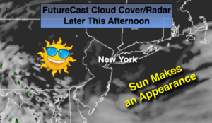
On Friday the low will pull into New England. Spotty showers are possible but the sun will make an appearance as well.
The beginning of the Memorial Day Weekend looks decent with sunshine and warm readings on Saturday. Actually, Saturday looks like the best day of the three. The shower threat returns Sunday. It doesn’t look like a complete washout with sun giving way to clouds and showers later in the day. The system looks to influence our weather into Memorial Day with spotty showers. Again, not a washout.
Stay tuned.
Today:
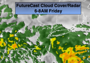
Occasional rain. Highs in the lower 60s. Northeast winds at 10-20mph.
Tonight:
A period of heavy rain and thunderstorms is possible for a few hours in the evening. Lows in the 50s throughout. Northeast to Northwest winds at 5-10mph.
Friday:
Clouds and sun. Spotty showers. Highs in the near 70º.
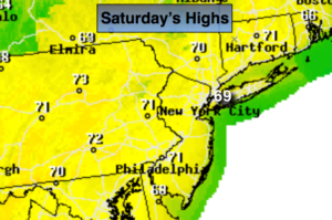
Saturday:
Partly sunny and warm. Highs in the mid 70s.
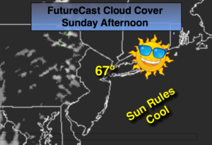
Sunday:
Morning sun. Scattered afternoon showers. Highs around 70º.
Memorial Day:
Clouds and sun. Scattered showers. Highs in the lower 70s.
Keep it here for a no nonsense, no hype forecast.