Clouds to Sun Today as Winter Says Goodbye…


Synopsis:

A storm will move well off the East coast today. Any clouds will give way to mostly sunny skies. Temperatures will be a few degrees below average.

Spring arrives tomorrow at 6:28AM.  It will feel like a typical first day of Spring with highs around 50º under mostly sunny conditions.

A mild day is expected Tuesday ahead of a cold front.

A cold blast arrives midweek with highs only in the upper 30s Wednesday.

Stay Tuned.

Today:

Becoming mostly sunny and breezy. Highs in the mid 40s. North wind at 15-25mph.

Tonight:

Mostly clear. Lows in the lower to mid 30s in the City, the 20s inland. Northwest winds diminishing to 8-12mph after midnight.

Monday:

Mostly sunny, more seasonal. Highs around 50º. The average high is 50º. Spring arrives at 6:28am.

Tuesday:

Partly sunny. Highs in the lower 50s.

Wednesday:

Mostly sunny, much colder Highs in the mid to upper 30s.

Thursday:

Sunny and chilly. Highs in the lower 40s.

Stay Tuned.

Keep it here for a no nonsense, no hype forecast.


Last Weekend of Winter Features Snow a Bit of Snow…


Synopsis:

A clipper (rapidly moving storm) will move from the Great Lakes and through the area this weekend. On and off rain and wet snow showers are likely today. The latest computer guidance shows the storm now developing farther off the coast. This will result in some light wet snow at times tonight into Sunday morning. Any wet snow will taper off at the coast Sunday morning as the system moves farther offshore. The sun will return later in the day.  A coating is likely in spots, especially on colder surfaces. This will not be a big deal.

Spring arrives on Monday at 6:28AM and not soon enough.

Stay Tuned.


Today:

On an off rain and snow showers. Highs in the upper 30s to lower 40s. East winds at 10-20mph.

Tonight:

Scattered areas of light wet snow. Lows around freezing in the City, the upper 20s inland. West to East winds at 5mph.

Sunday:

Early morning snow is possible, especially by the coast otherwise becoming partly sunny. Highs in the lower 40s.

Monday:

Partly sunny. Highs in the mid 40s. Spring arrives at 6:28am.

Tuesday:

Partly sunny, more seasonal. Highs in the upper 40s. The average high is 50º.

Wednesday:

Partly sunny, much colder Highs in the upper 30s.

Stay Tuned.

Keep it here for a no nonsense, no hype forecast.


Fine Finish to the Workweek. Watching Coastal System this Weekend…


Synopsis:

High pressure over the Southeast will result in plenty of sunshine and milder readings for today.

A disorganized area of low pressure will work in from the Ohio Valley Friday night.  The system has good upper level support so as it approaches and moves off the NJ coast it should strengthen. Rain and snow showers are likely on Saturday.  By Saturday night the strengthening storm South of Long Island should throw back an arc of snow toward the coast. How far West this snow gets is still in question.  At this time, please be aware that an accumulation is possible. The second map above is where the stripe of accumulating snow is possible. We’ll fine tune possible amounts later this afternoon. Most of what falls will be at night so the strong March sun will not be a factor in limiting accumulation. The system will move farther offshore Sunday.  The sun will return later in the day.

Spring arrives on Monday at 6:28AM and not soon enough.

Stay Tuned.

Today:

Mostly sunny. Pleasant. Highs in the lower 40s. West to Northwest winds at 8-12mph.

Tonight:

Mostly clear then becoming cloudy late. Rain and snow showers possible toward dawn. Lows around freezing in the City, the 20s inland. West to Northeast winds at 5mph.

Saturday:

Periods of rain and or wet snow. Highs in the upper 30s to lower 40s.

Sunday:

Early morning snow is possible, especially by the coast otherwise becoming partly sunny. Highs in the lower 40s.

Monday:

Partly sunny. Highs in the mid 40s. Spring arrives at 6:28am.

Tuesday:

Partly sunny, more seasonal. Highs in the upper 40s. The average high is 50º.

Stay Tuned.

Keep it here for a no nonsense, no hype forecast.


Flirting with Freezing. Sun Returns…


Synopsis:

An unusually cold airmass will be over the Northeast through today with a persistent Northwesterly flow from Canada. The sun will finally make an appearance and winds won’t be as strong.

Temperatures will finally reach 40º by tomorrow as the storm over Eastern Canada loses its influence on our area. The average high is 50º.

A disorganized area of low pressure will work in from the Ohio Valley Friday night and Saturday. At this time, light rain, or a mix of wet snow and rain is possible.

Stay Tuned.

Today:

Partly sunny, breezy and cold. Highs in the lower 30s. West Northwest wind at 15-25mph.

Tonight:

Mostly clear and very cold. Lows in the mid 20s in the City, teens inland. Northwest winds at 10-15mph.

Friday:

Mostly sunny. Not as harsh. Highs around 40º.

Saturday:

Rain and or wet snow showers, otherwise mostly cloudy. Highs in the lower 40s.

Sunday:

Partly sunny. Highs in the lower 40s.

Monday:

Mostly cloudy. Highs in the mid 40s. Spring arrives at 6:28am.

Stay Tuned.

Keep it here for a no nonsense, no hype forecast.


Early Snow Showers. Bitterly Cold Overnight…


Synopsis:

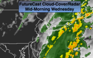
Energy pivoting around the a storm will caused scattered snow showers this evening. Some areas may pick up a quick coating. An unusually cold airmass will be over the Northeast through tomorrow with a persistent Northwesterly flow from Canada. Winds will continue to be brisk though tomorrow making for very low wind chills.

Temperatures will finally reach 40º by weeks end as the storm over Eastern Canada loses its influence on our area.

A disorganized area of low pressure will work in from the Ohio Valley Friday night and Saturday. At this time, light rain, or a mix of wet snow and rain is possible.

Stay Tuned.

Tonight:

Leftover snow showers, otherwise mostly cloudy. Lows around 20º in the City, the teens inland. West to Northwest winds at 15-25mph with higher gusts. Wind Chills will be in the single digits and teens, almost unheard of for mid March.

Thursday:

Partly sunny, breezy and cold. Highs in the mid 30s. West Northwest wind at 15-25mph.

Friday:

Mostly sunny. Not as harsh. Highs around 40º.

Saturday:

Rain and or wet snow showers, otherwise mostly cloudy. Highs in the lower 40s.

Sunday:

Partly sunny. Highs in the lower 40s.

Monday:

Mostly cloudy. Highs in the mid 40s. Spring arrives at 6:28am.

Stay Tuned.

Keep it here for a no nonsense, no hype forecast.


Mostly Cloudy. Very Cold & Windy. PM Snow Showers


Synopsis:

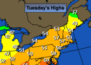
The storm that plagued our region with heavy snow, sleet, rain and wind will continue to move into Northern New England today. An unusually cold airmass will be over the Northeast in its wake. Temperatures will be hard pressed to get to freezing and the winds will gust to over 40mph. Making for wind chills in the teens.  Energy pivoting around the storm will spark a round of snow showers this afternoon. Some areas may pick up a quick coating.

The next couple of days will be influenced by the strong storm in Eastern Canada. Winds will be busy through tomorrow with below average temperatures.

Temperatures will finally reach 40º by weeks end.

A disorganized area of low pressure will work in from the Ohio Valley Friday night and Saturday morning. At this time, light rain, or a mix of wet snow and rain is possible.

Stay Tuned.

Today:

Mostly cloudy. Snow showers, most likely in the afternoon. Windy and cold. Highs around freezing. West to Northwest winds at 15-30mph with gusts to 40mph.

Tonight:

Leftover snow showers, otherwise mostly cloudy. Lows around 20º in the City, the teens inland. West to Northwest winds at 15-25mph with higher gusts.

Thursday:

Partly sunny, breezy and cold. Highs in the mid 30s.

Friday:

Mostly sunny. Not as harsh. Highs around 40º.

Saturday:

Morning rain and or wet snow, otherwise becoming partly sunny. Highs in the lower 40s.

Sunday:

Partly sunny. Highs in the lower 40s.

Stay Tuned.

Keep it here for a no nonsense, no hype forecast.


Scattered Snow Showers Overnight. Refreeze. Gusty Winds…


Synopsis:

The storm that plagued our region with heavy snow, sleet, rain and wind will continue to move off the New England tonight.

Yes, I busted over a large part of the tri-state area with snow amounts. I’ll always admit a bust. It happens. Meteorology is a fluid science with the atmosphere constantly in motion and some parameters go by undetected. The NAM outperformed all the other models with this storm . I truly believe that many of us in this field, including myself, did not put enough wait on this model. With that being said I have milk and eggs for sale at the Marshall residence for half price!

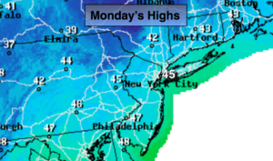
Scattered snow showers are expected overnight with an additional dusting in spots, otherwise mostly cloudy and cold. Gusty winds will continue. An standing water or slush will freeze solid.

The next couple of days will be influenced by the strong storm in Eastern Canada. Winds will be busy the next two days.  Another round of snow showers are possible Wednesday afternoon.

Temperatures will finally reach 40º by weeks end.

Tonight:

Leftover snow showers at times otherwise mostly cloudy. Lows around 20º in the City, the teens inland. West to Northwest winds at 15-30mph with higher gusts.

Wednesday:

Mostly cloudy. Snow showers, most likely in the afternoon. Windy and cold. Highs around freezing. West to Northwest winds at 15-30mph with gusts to 35mph.

Thursday:

Partly sunny, breezy and cold. Highs in the mid 30s.

Friday:

Mostly sunny. Not as harsh. Highs around 40º.

Saturday:

Morning rain and or snow showers, otherwise becoming partly sunny. Highs in the lower 40s.

Sunday:

Partly sunny. Highs in the lower 40s.

Stay Tuned.

Keep it here for a no nonsense, no hype forecast.


Storm Slowly Winds Down. High Winds Continue…


Synopsis:

The storm that plagued our region with heavy snow, sleet, rain and wind will continue to move toward Eastern Long Island and off the New England coast this afternoon and into tonight.

Yes, I busted over a large part of the tri-state area with snow amounts. I’ll always admit a bust. It happens. Meteorology is a fluid science with the atmosphere constantly in motion and some parameters go by undetected. The NAM outperformed all the other models with this storm . I truly believe that many of us in this field, including myself, did not put enough wait on this model. With that being said I have milk and eggs for sale at the Marshall residence for half price!

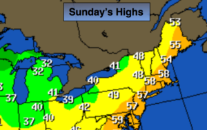
The heaviest precipitation will move North and East of the City this afternoon.  Scattered areas of light snow will be left behind the departing system (the what to expect map is above).

Stay safe and please clear the walkways before it all refreezes.

Tonight:

Leftover snow showers at times otherwise mostly cloudy. Lows around 20º in the City, the teens inland. West to Northwest winds at 15-30mph with higher gusts.

Wednesday:

Mostly cloudy. Snow showers. Windy and cold. Highs around freezing. West to Northwest winds at 15-30mph with gusts to 35mph.

Thursday:

Partly sunny, breezy and cold. Highs in the mid 30s.

Friday:

Mostly sunny. Not as harsh. Highs around 40º.

Saturday:

Morning rain and or snow showers, otherwise becoming partly sunny. Highs in the lower 40s.

Sunday:

Partly sunny. Highs in the lower 40s.

Stay Tuned.

Keep it here for a no nonsense, no hype forecast.


Historic Storm N/W. Blizzard Warnings/Winter Storm Warnings…


Synopsis:

***Blizzard & Winter Storm Warnings are in effect for inland areas Today***

Blizzard is defined as:

1)Heavy falling Snow or blowing snow

2)Visibility below 1/4mile

3)Winds in excess of 35mph

These conditions need to persist for 3 or more consecutive hours.

The latest computer guidance continues to suggest that epic amounts of snow are likely for areas North & West of New York City (potential snow amounts, warnings and What to Expect graphics are above). The storm will be going through bombogenesis (a rapidly intensifying storm where the pressure falls are very dramatic) just off the coast of NJ. This will bring Snowfall rates of 2″-4″ and hour over inland areas this morning. The brunt of the storm will be from now into mid-day. Thunder snow is possible with whiteout conditions. The latest models show the intense storm now hugging the coast of NJ and Long Island. Because of this development with the track of the storm coastal NJ many areas have gone over to rain or sleet. This will cut back on snow amounts greatly. Areas from the City and Eastward into Long Island will experience this warming as well, resulting in a cutback in snow totals.

Coastal flooding is possible at times of high tides. Winds will gust between 40-60mph on the coast and to 35-40 mph inland. Scattered power outages are a concern do to the highs winds and heavy wet snow that may bring down tree limbs.

Please be safe.

Stay tuned.

Today:

Snow. Heavy at times inland. Heavy sleet back to snow later this morning along the I-95 corridor. Windswept rain along the coast. Very windy, especially at the coast. Highs around freezing. Northeast to Northwest wind at 15-35mph gusts to 60mph at the coast.

Tonight:

Leftover snow showers are times otherwise mostly cloudy. Lows around 20º in the City, the teens inland. Northwest winds at 15-30mph with higher gusts.

Wednesday:

Mostly cloudy. Snow showers. Windy and cold. Highs around freezing.

Thursday:

Partly sunny, breezy and cold. Highs in the mid 30s.

Friday:

Mostly sunny and chilly. Highs in the upper 30s.

Saturday:

Mostly cloudy. Scattered snow showers. Highs around 40.

Stay Tuned.

Keep it here for a no nonsense, no hype forecast.


Blizzard Warning & Winter Storm Warnings: Tonight & Tuesday…

Synopsis:

***Blizzard Warning is in effect for all of New York City, much of Long Island, coastal Connecticut & Eastern NJ. Winter Storm Warnings are in effect for the remainder of the tri-state area for late tonight and Tuesday***

Today will be the calm before the storm. High pressure will remain over the Northeast and continue to maintain the cold air that has been in place.

The latest computer guidance suggests that the storm potential will become a reality as all of the models have epic amounts of snow on the way. The models show the storm is stronger and has higher precipitation amounts. The snow will get going around midnight and come down heavy at times later tonight and Tuesday morning. Snowfall rates of 1″-3″ and hour are likely. The brunt of the storm will be from 4AM-Mid-day Tuesday. Thunder snow is possible with whiteout conditions. Coastal flooding is possible at times of high tides on Tuesday. Winds will gust between 40-60mph on the coast. Scattered power outages are a concern do to the highs winds and heavy wet snow that may bring down tree limbs.

A few questions that still need to be answered and probably won’t get answer until just before the storm gets going is: How much mixing occurs along the coast? Where does the heaviest precipitation banding set up?

Stay tuned.

Today:

Mostly sunny and chilly. Highs in the mid 30s. Northwest to Southeast wind at 5mph.

Tonight:

Snow developing around midnight. The snow will become heavy at times. Lows in the mid 20s in the City, around 20º inland. Winds becoming Northeast and increasing to 15-30mph.

Tuesday:

Snow. Heavy at times. A mix at times at the coast. Very windy, especially at the coast. Highs around freezing.

Wednesday:

Mostly cloudy. Snow showers. Windy and cold. Highs around freezing.

Thursday:

Partly sunny, breezy and cold. Highs in the mid 30s.

Friday:

Partly sunny, breezy and chilly. Highs in the upper 30s.

Stay Tuned.

Keep it here for a no nonsense, no hype forecast.