Synopsis:.
The storm off the Northeast coast will continue to move away tonight. In its wake an upper level low will swing by tonight. With this feature a steadier light rain is expected. It maybe cold enough well North and West for the rain to mix with snow. The higher elevations may see a coating. The best chance for this happening is North of the City in Lower NY State where the precipitation will be the heaviest.
Early morning clouds Tuesday will give way to sunshine. It will be more tolerable.
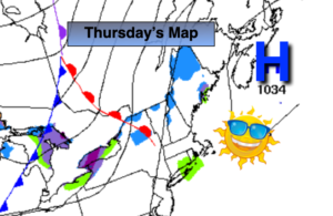
A bright day is expected for Wednesday and Thursday as high pressure moves in from the West. Temperatures will remain below normal then rise to near seasonal averages by Thursday.
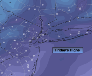
A cold front will approach Friday. Ahead of it it’ll be mild under a mix of sun and clouds. An isolated shower is possible later in the day.
On Saturday the models are all over the place. The GFS has high pressure over the region and a nice day. The European has a low approaching from the West and rain.
Stay Tuned.
Keep it here for a no hype, no nonsense forecast.
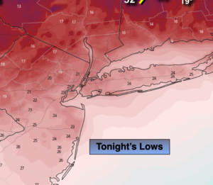
Tonight:
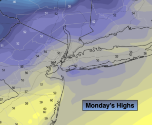
A period of light rain is likely. The rain may mix with a change to wet snow late well North and West. The best chance for this to occur is over Orange and Putnam counties and North. Lows in the 30s throughout. North to West winds at 5-10mph.
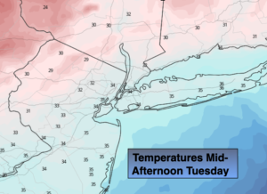
Tuesday:
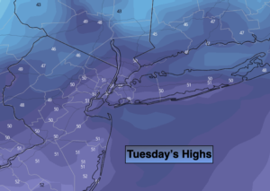
Morning clouds, otherwise skies will be partly sunny. Highs around 50º. West to Northwest winds at 5-10mph.
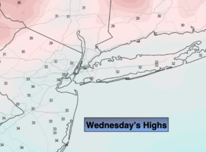
Wednesday:
Mostly sunny. Highs in the upper 40s.
Thursday:
Mostly sunny. Highs in the lower 50s.
Friday:
Sun and clouds, milder. Spotty PM showers. Highs in the upper 50s.
Saturday:
Sun and clouds. Much cooler with a chance of showers. Highs in the upper 40s.