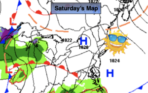
Synopsis:
The better half of the weekend will be today. Bright and mild conditions are expected as high pressure dominates the Mid-Atlantic. Readings will be ten to fifteen degrees above the average high of the lower 50s.
Clouds will increase tonight ahead of low pressure developing to the West.
On and off rain is expected for Sunday. It’ll be mild and winds will become strong once again during the afternoon. We’ll have to keep our eye on a possible squall line during the evening with an approaching cold front.
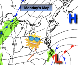
Monday through Wednesday will be dry with near to above average readings as high pressure dominates and March comes to a close.
Keep it here for a no nonsense, no hype forecast.
Today:
Mostly sunny. Mild. Highs in the mid to upper 60s. Northwest to Southwest winds at 5-10mph.
Tonight:
Increasing clouds. Mild. Lows in the 40s throughout. South to Southeast winds at 5mph.
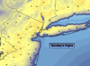
Sunday:
On and off rain. Becoming windy. Highs in the lower 60s.
Monday:
Partly sunny. Seasonal. Highs in the lower to mid 50s.
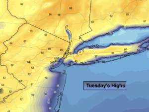
Tuesday:
Sunny. Highs in the upper 50s.
Wednesday:
Partly sunny. Highs in the lower 60s.