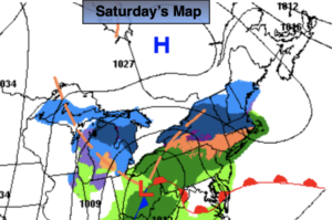
Synopsis:
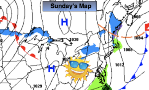
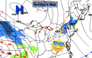
Sunday will be the better half of the weekend with abundant sun with above average temperatures. The average high is 42º. The wind will be busy.
Weak low pressure over the Great Lakes will weaken as it approaches the region on Monday. Sun will give way to thickening clouds. Flurries are possible during the afternoon.
A mixed sky is on tap for Tuesday. Temperatures will still be above average.
Wednesday will feature low pressure moving in. Showers are possible.
We’ll get another chance of showers again on Thursday as another weak system rapidly moves through.
Stay tuned..
Sunday:
Sunny, breezy and mild. Highs in the upper 40s. Northwest winds at 10-20mph with higher gusts.
Tonight:
Clear. Lows in the lower to mid 30s in the City, the 20s inland. Northwest winds at 8-12mph.
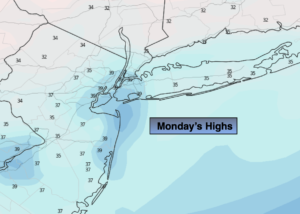
Monday:
Early sun, otherwise thickening clouds with a chance of afternoon flurries. Seasonal. Highs in the lower 40s.
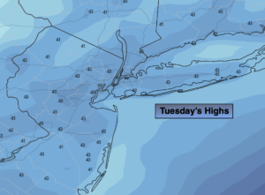
Tuesday:
Partly sunny. Mild. Highs in the upper 40s.
Wednesday:
Showers possible. Mild. Highs in the upper 40s.
Thursday:
Showers possible. Mild. Highs in the upper 40s.