Synopsis:
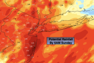
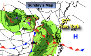
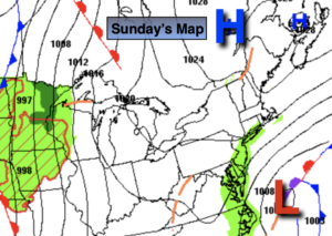
On Mother’s Day, the storm that has been like an unwanted houseguest will continue to meander off the coast. This will result in scattered coastal showers. Farther inland, it should remain rain-free. It’ll be brisk and unseasonably chilly. Highs once again will remain well below average of 69º-staying in the 50s. The day will be dominated by clouds.
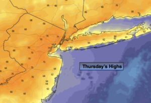
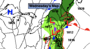
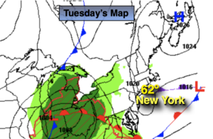
The low will remain in the Western Atlantic through the first half of the week. High pressure will nose down from the Canadian maritimes. This will result in the sun dominating the sky but the winds will continue to be busy. Temperatures will moderate each and every day with readings finally getting to near seasonable levels by Wednesday. Thursday will be warm with readings above average for the first time in a long time. It will get better in steps!
Stay tuned.
Keep it here for a no hype, no nonsense forecast.
Mother’s Day:
Scattered coastal showers, otherwise remaining mainly cloudy, breezy and cool. Highs in the mid to upper 50s. Northeast winds at 15-25mph with gust to 30mph.
Tonight:
Becoming partly cloudy. Lows in the mid 40s in the City, the 30s inland. Northeast winds 10-20mph.
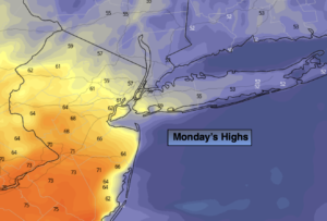
Monday:
Mostly sunny. Breezy. Highs in the mid 60s.
Tuesday:
Sunny. Breezy. Highs in the upper 60s.
Wednesday:
Sunny. Highs around 70º.
Thursday:
Sunny. Warmer. Highs in the mid 70s.
Catch me on the Fox Business Network from 6-9am this weekend and the Fox Weather Stream from until Noon. Find us on Tubi, Roku TV and YouTube TV and as always the Fox Weather App. It’s Free!