Synopsis:
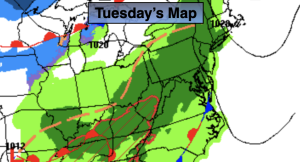
Low pressure will develop over Eastern North Carolina today and move just east of our region through Friday. Winds will become gusty through the period.
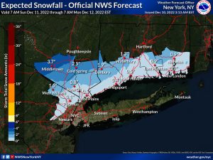
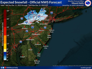
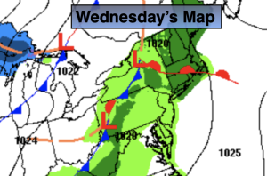
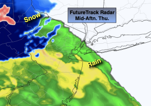
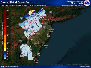
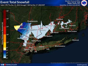
Rain will develop from Southwest to Northeast from late morning through mid-afternoon today. Well inland it will be just cold enough for snow or rain and snow. Possible amounts are above. As. you can see it’s a small area that will see the white stuff.
The rain will continue overnight with a mix well inland. On and off rain is likely through Friday, again with a mix well inland.
The weekend looks bright and chilly as a Northwest flow develops. Highs will be near the average of the lower 40s.
Tranquil conditions are expected for the beginning of the week.
Stay tuned.
Keep it here for a no hype, no nonsense forecast.
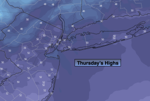
Thursday:
Rain developing. A mix well inland. Highs in the upper 30s to around 40º. East to Northeast winds increasing to 10-20mph with gusts to 30mph late at the coast.
Tonight:
Rain. A mix well inland. Windy, especially at the coast. Lows in the 30s throughout. Northeast winds at 15-25mph with gusts to 35mph and the coast.
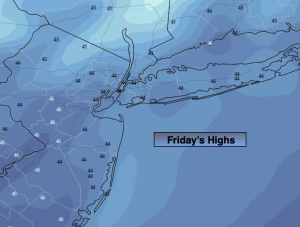
Friday:.
On and off rain. A mix well inland. Highs around 40º.
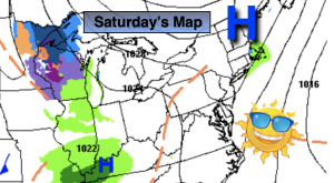
Saturday:
Partly sunny. Highs in the lower 40s.
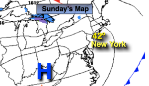
Sunday:
Partly sunny. Highs in the lower 40s.
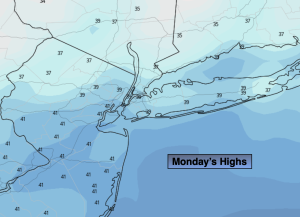
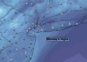
Monday:
Mostly sunny. Highs around 40º.