Synopsis:.
Above average temperatures are expected through Saturday for most of the region (excluding coastal areas) as high pressure off the Southeast coast continues to influence our region. A mix of sun and clouds is expected into the first half of the weekend.
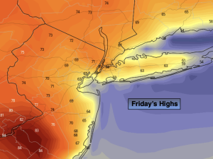
There will be a very weak frontal boundary over the region through Saturday. All this weather system will carry with it is a difference in wind direction. To the East of the boundary the wind will be blowing off the colder Atlantic to the West of the boundary the wind will be more off the land. This will result in a large difference in temperatures from the coast to well inland through Saturday. Areas well away from the ocean will be warm on Friday, while some coastal communities will be almost twenty degrees cooler. This is very typical in the Spring in our region.
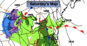
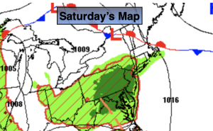
A significant cold front will move into the region on Saturday night and Sunday morning with a period rain. Sunday will not be a washout. Morning showers will give way to afternoon sun. Readings will be a few degrees above the average high of 64º.
More seasonable conditions are expected for Monday and Tuesday under a mix of sun and clouds.
Stay tuned.
Keep it here for a no nonsense, no hype forecast.
Friday:
Mostly sunny. Warm inland, cooler at the coast.. Highs in the lower 70s in the City, upper 70s inland, 60s and upper 50s at the coast. East to Southeast winds at 8-12mph.
Tonight:
Partly cloudy with areas of fog. Lows in the mid 50s in the City, the the upper 40s and 50s inland. Light Southeast to East wind.
Saturday:
Partly sunny, breezy and mild. Highs in the mid 70s. Warmer inland, cooler at the coast. Rain will move in by sunset.
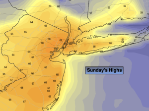
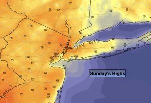
Sunday:
Morning showers to afternoon sun. Highs in the upper 60s.
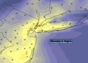
Monday:
Partly sunny. Seasonable. Highs in the mid 60s.
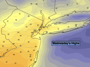
Tuesday:
Partly sunny. Cool. Highs in the lower 60s.