Synopsis:.
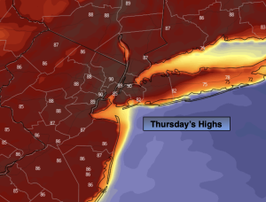
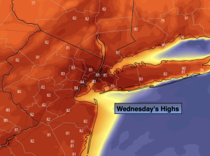
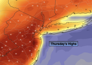
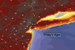
Our Summer-like readings with abundant sunshine will continue for one more day as high pressure off the Southeast coast continues to be responsible for our July-like conditions. Record high temperatures were set on Thursday and the City hit a high of 90º. Readings will be similar today. The record high of 85º for Central Park on Friday is in jeopardy.
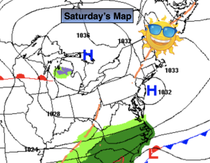
The weekend will be much cooler with clouds winning the battle as a Southerly flow brings up some moisture. Saturday morning should be dry. Showers are likely by afternoon. Sunday should be mainly dry but mainly grey. Readings will still be several degrees above the average high of 61º.
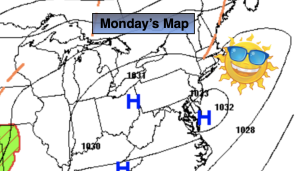
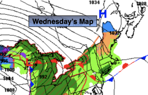
A cool front will slowly move into the region on Monday. Showers are likely.
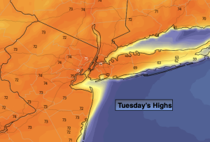
Tuesday will feature much cooler readings under a mix of sun and clouds as a Canadian air mass makes a visit.
Stay tuned.
Keep it here for a no nonsense, no hype forecast.
Friday:
Mostly sunny. Very Warm. Highs in the mid 80s to around 90º. Much cooler at the immediate coast. West to South winds at 8-12mph.
Tonight:
Mostly cloudy. Lows in the lower 60s in the City, the 50s all other locations. South to Southeast winds at 5mph.
Saturday:
More clouds than sun. Not as warm. Scattered afternoon showers likely. Highs around 70º.
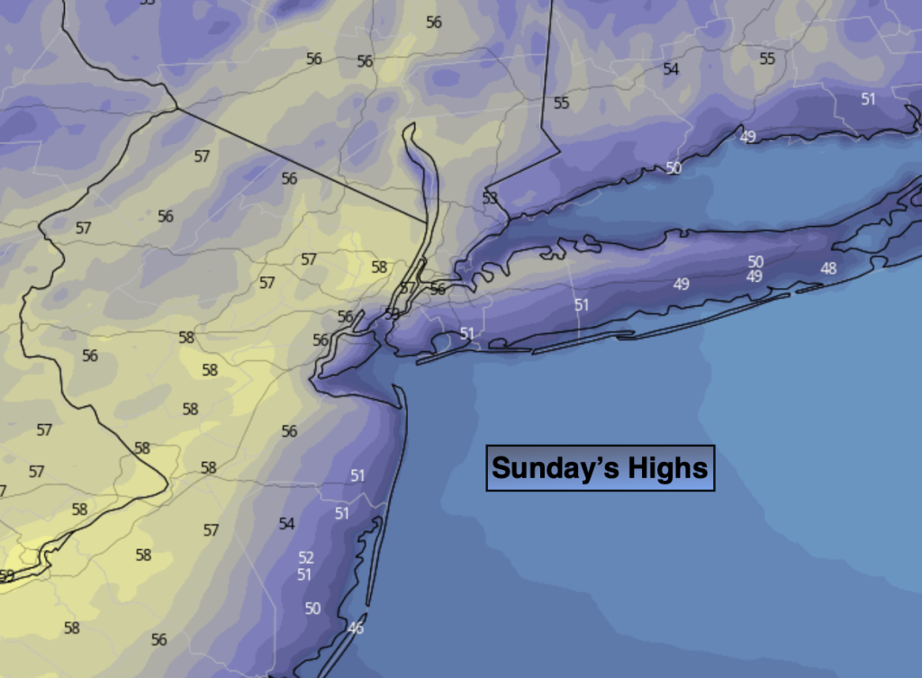
Sunday:
Mostly cloudy. Cooler. Highs in the mid 60s.
Monday:
On and off showers. Highs in the mid 60s.
Tuesday:
Partly sunny. Cooler. Highs in the upper 50s.