Synopsis:
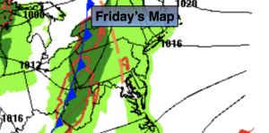
Low pressure will move off into the Canadian Maritimes on Friday allowing for high pressure to build in from the North. This will result in a slightly cooler temperatures than recent days. Despite the slight dip in readings it’ll still be a delightful Friday with abundant sunshine.
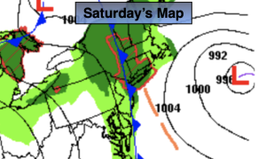
A dramatic change in weather will occur on Saturday as low pressure moves our way from the Ohio Valley. Rain will develop. The question is the timing. Does it start in the early morning or hold off until afternoon. The latest computer models want to slow the start time of the rain. The morning may turn out dry (maybe a few showers) with rain moving in during the afternoon. Anyway you slice, it’ll have a damp feel. Rain is likely Saturday night into Sunday morning. The low now looks to exit quickly enough on Sunday for a dry afternoon. The sun will make a return. Below average temperatures are expected this weekend. The average high is in the mid 60s.
Monday and Tuesday will feature an upper level low over the region. More clouds than sun is expected with the chance of spotty showers. Low pressure at the surface will develop offshore and move out to sea. Signifiant rain at this time is not expected for the region.
Stay tuned.
Keep it here for a no nonsense, no hype forecast.
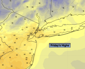
Friday:
Sunny. Highs in the lower to mid 60s. North to Northwest winds at 8-12mph.
Tonight:
Mostly clear early, otherwise increasing clouds. Lows around 50º in the City, the upper 30s and 40s inland. North winds at 5mph.
Saturday:
Rain developing. Highs in the upper 50s.
Sunday:
Morning rain. Skies should become partly sunny during the afternoon. Highs in the upper 50s to lower 60s.
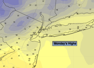
Monday:
More clouds than sun. Spot shower. Highs around 60º.
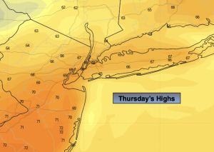
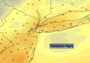
Tuesday
More clouds than sun. Spot shower. Highs in the upper 50s.